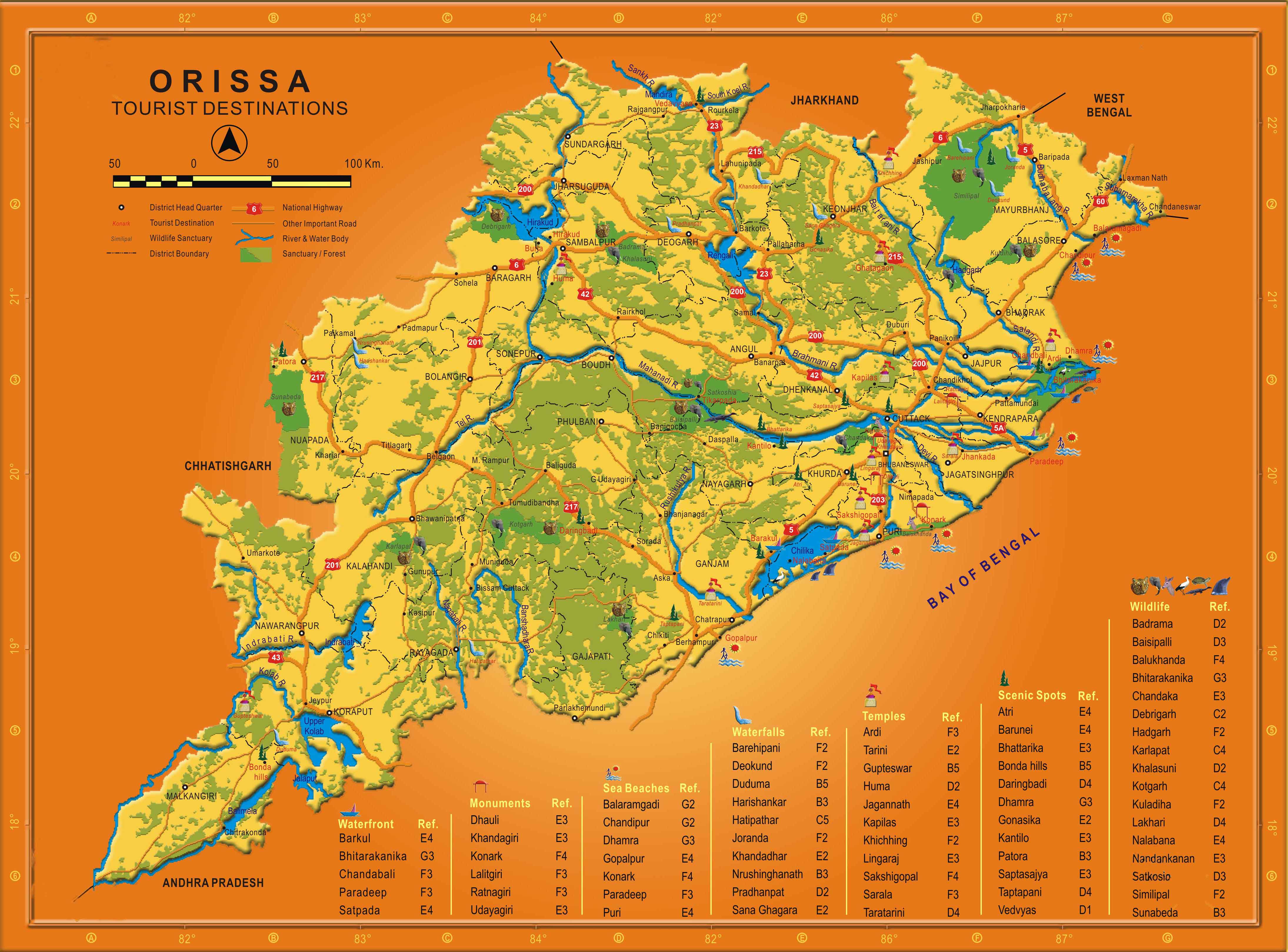
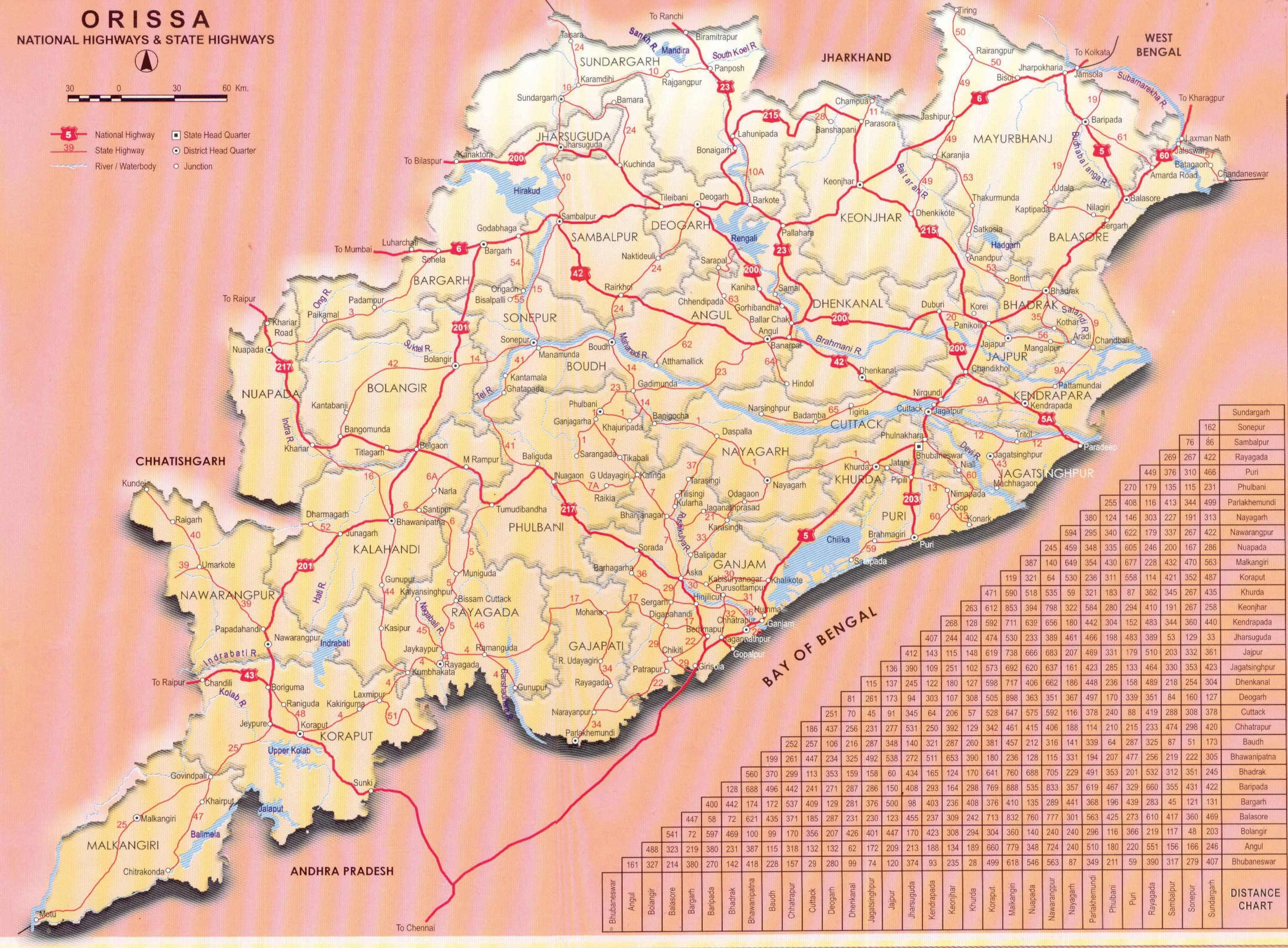
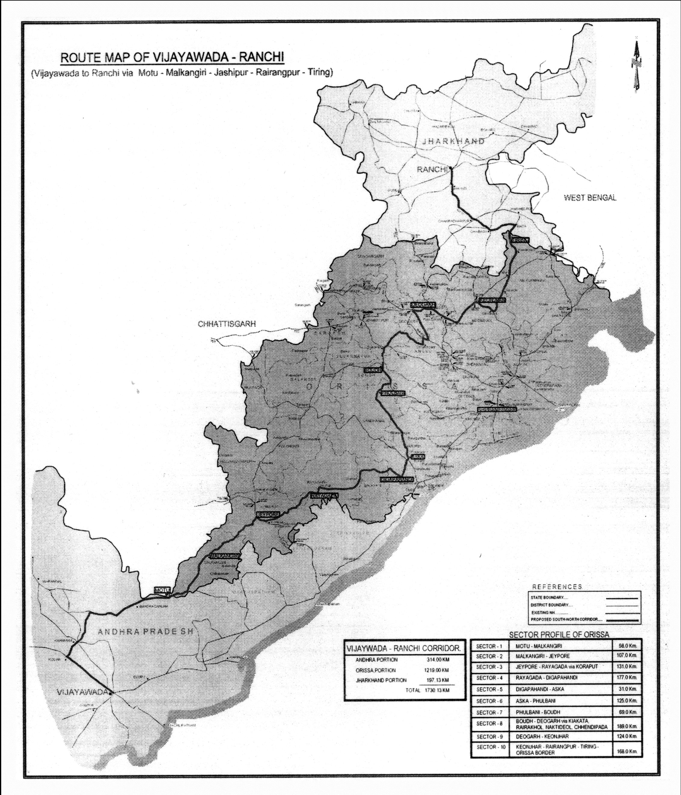
Progress on the Ranchi-Vijaywada highway zig-zagging through 1219 kms of Orissa
Angul, Balangir, Bouda, BRGF: Backward districts program, Central grants, Deogarh, Extremist infested districts program, Gajapati, Ganjam, Kandhamala, KBK Plus district cluster, Keonjhar, Koraput, Malkangiri, Mayurbhanj, Rayagada, Sambalpur, Sonepur, Uncategorized, Vijaywada-Ranchi highway June 7th. 2007, 10:02amAnubhuti Bishnoi in Indian Express reports on the progress towards making a 2-lane Ranchi-Vijaywada highway zig-zagging through 1219 kms of Orissa and passing though most of its tribal districts, many of which are naxalite infested. The article has a nice map showing which towns the road will pass through in Orissa. Following are some excerpts from that article. (Thanks to Manoj Sahu in Africa for mentioning this article in Agami Orissa.)
At a recent meeting chaired by Prime Minister Manmohan Singh, the Ministry of Shipping, Road Transport and Highways was asked to expedite finalisation of the Detailed Project Report (DPR) for the Vijayawada-Ranchi corridor cutting through Orissa, and take it up on a priority basis. … Around 1,219 km of the 1,729-km corridor planned between Vijayawada and Ranchi will fall in Orissa, and the state government had requested that its state highways, district and rural roads be incorporated in the corridor. Now 235.8 km of national highway sections, 878 km of state high ways and 104.5 km of rural roads will be a part of the corridor. The road from Vijayawada enters Orissa at Motu in Malkangiri district and leaves at Tiring in Mayurbhanj district on the north. … While the Ministry may not call the stretch NH as yet, with the Prime Minister taking a keen interest, it is set to be developed as per national highway standards. What that means is that tribal areas of Koraput, Malkangiri, Rayagada, Gajapati, Ganjam, Kandhamal, Anugul, Sambalpur, Deograh, Keonjhar, Mayurbhanj and Boudh, currently insurgency hotbeds, may emerge out of the hinterlands. Confirming that the project had been put on the fast track, a senior Ministry of Shipping, Road Transport and Highways official said: “The DPR of the corridor is underway and should be ready in six-seven months.”
Note: As mentioned by Digambara a map of the route is at http://tathya.in/story.asp?sno=592. I removed the faulty map that Indian Express printed.


.jpg)
June 8th, 2007 at 10:57 pm
I think the map earlier produced in Tathya.in ( http://tathya.in/story.asp?sno=592 ) has more accurate road map information than the present one. In the present case it has mentioned about only the districts through which it passes through. Some are not accurate. I think it will not pass Balangir rather Boudh district.
June 9th, 2007 at 12:18 pm
I think you are right.