The districts of Odisha that are behind and need special attention
Overall Odisha July 22nd. 2011, 10:14amWe present a set of maps that illustrate the districts that are behind the rest of the state and that need special attention.
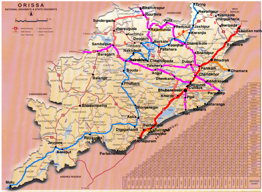
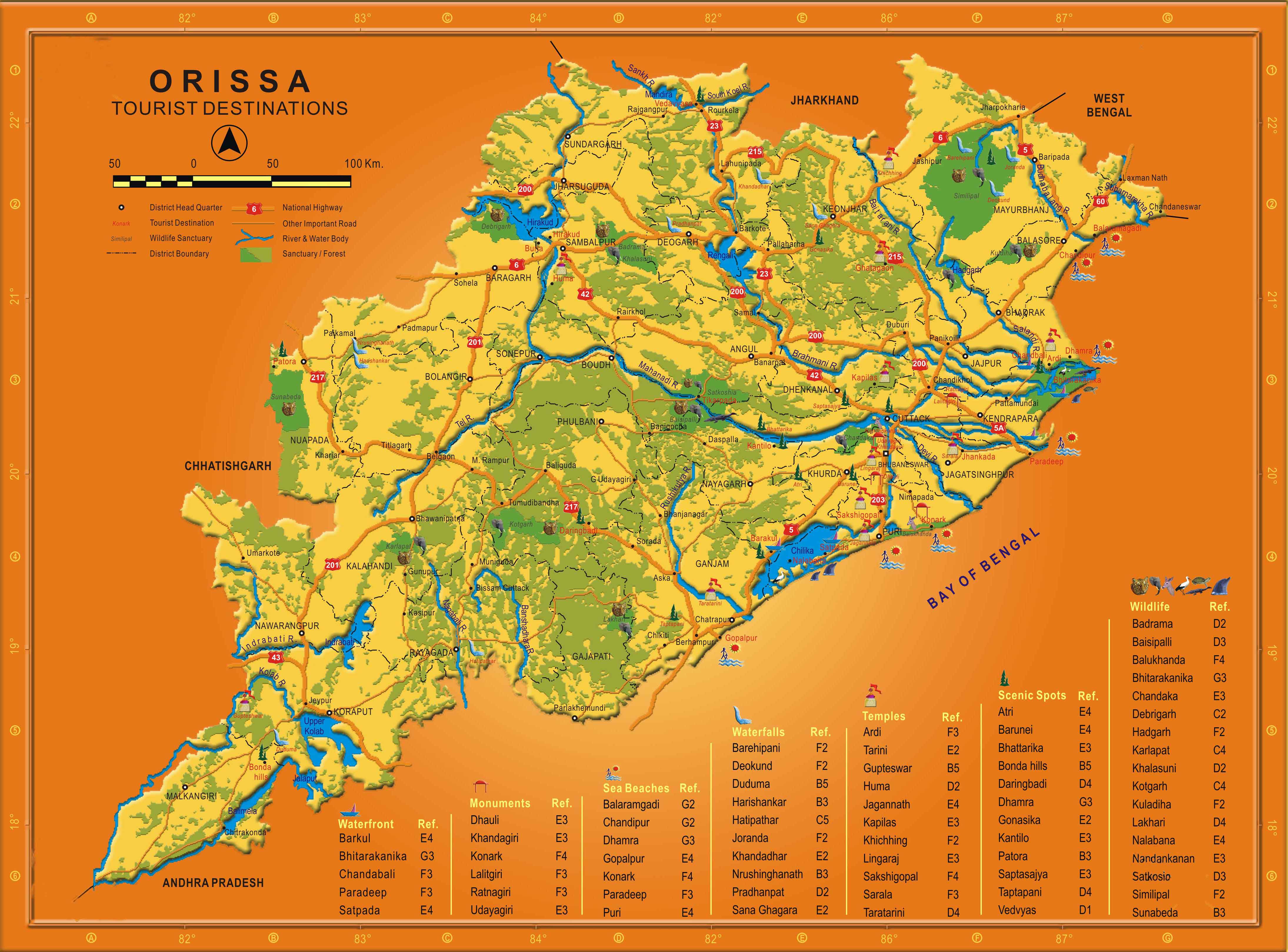
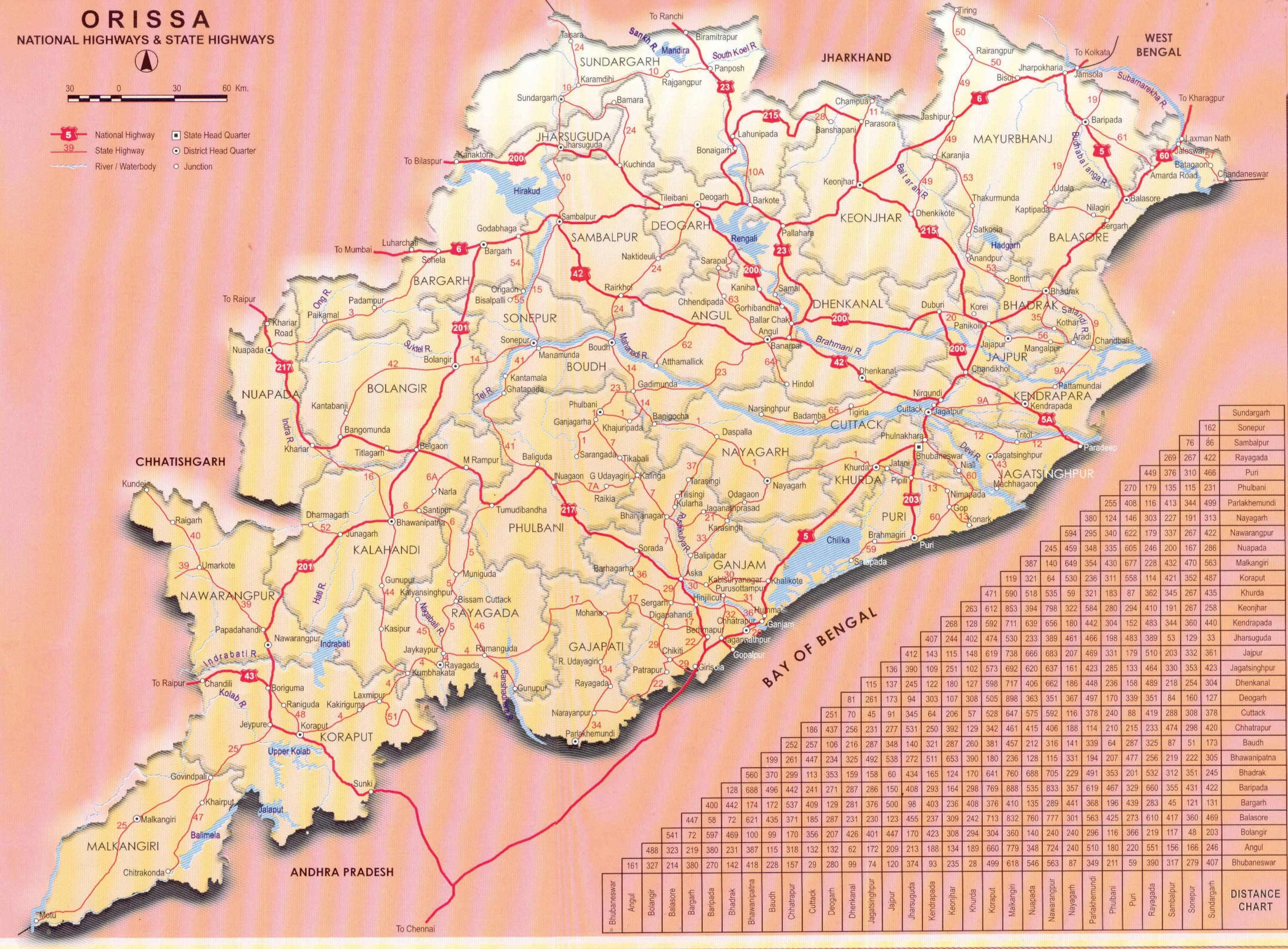
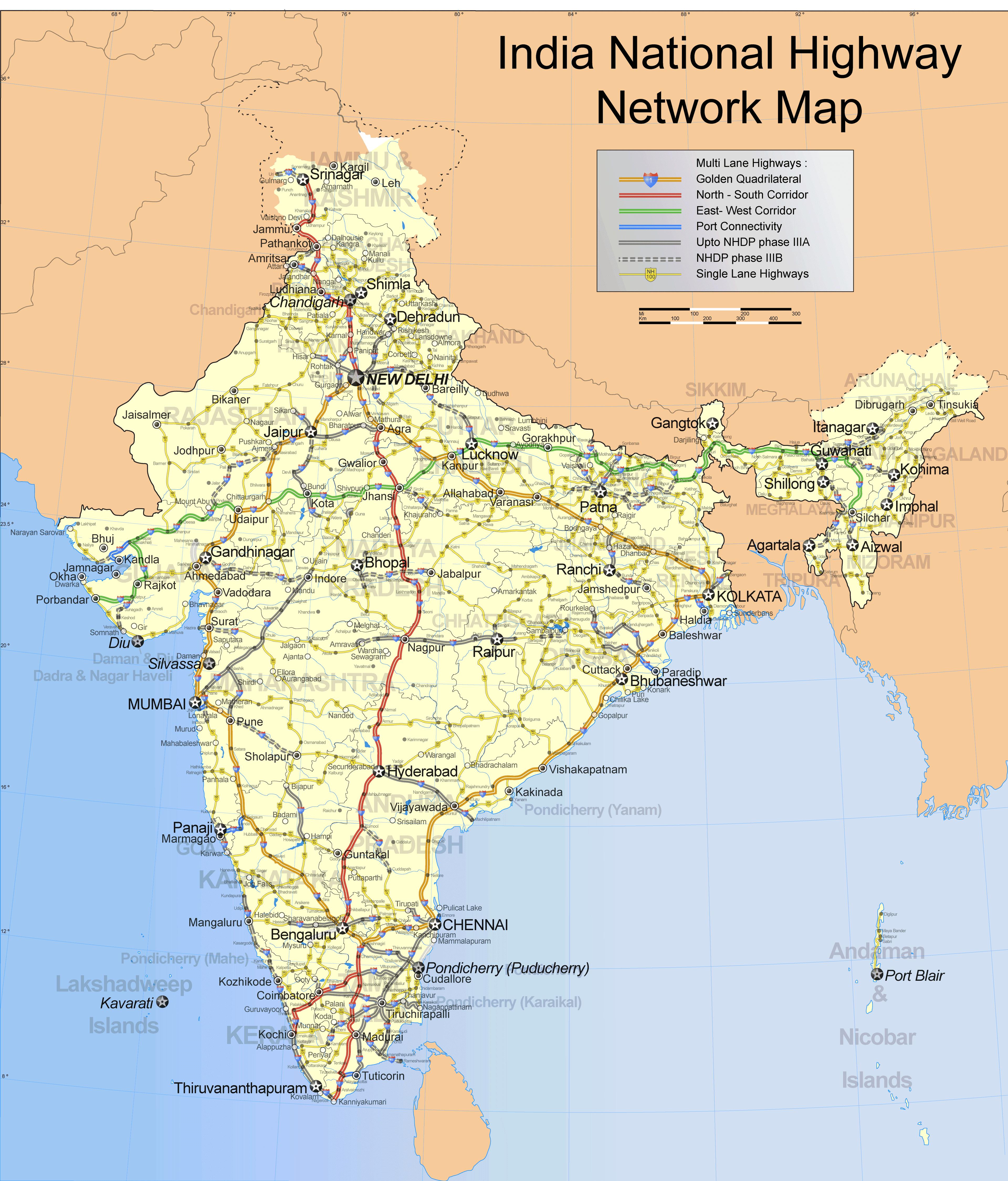
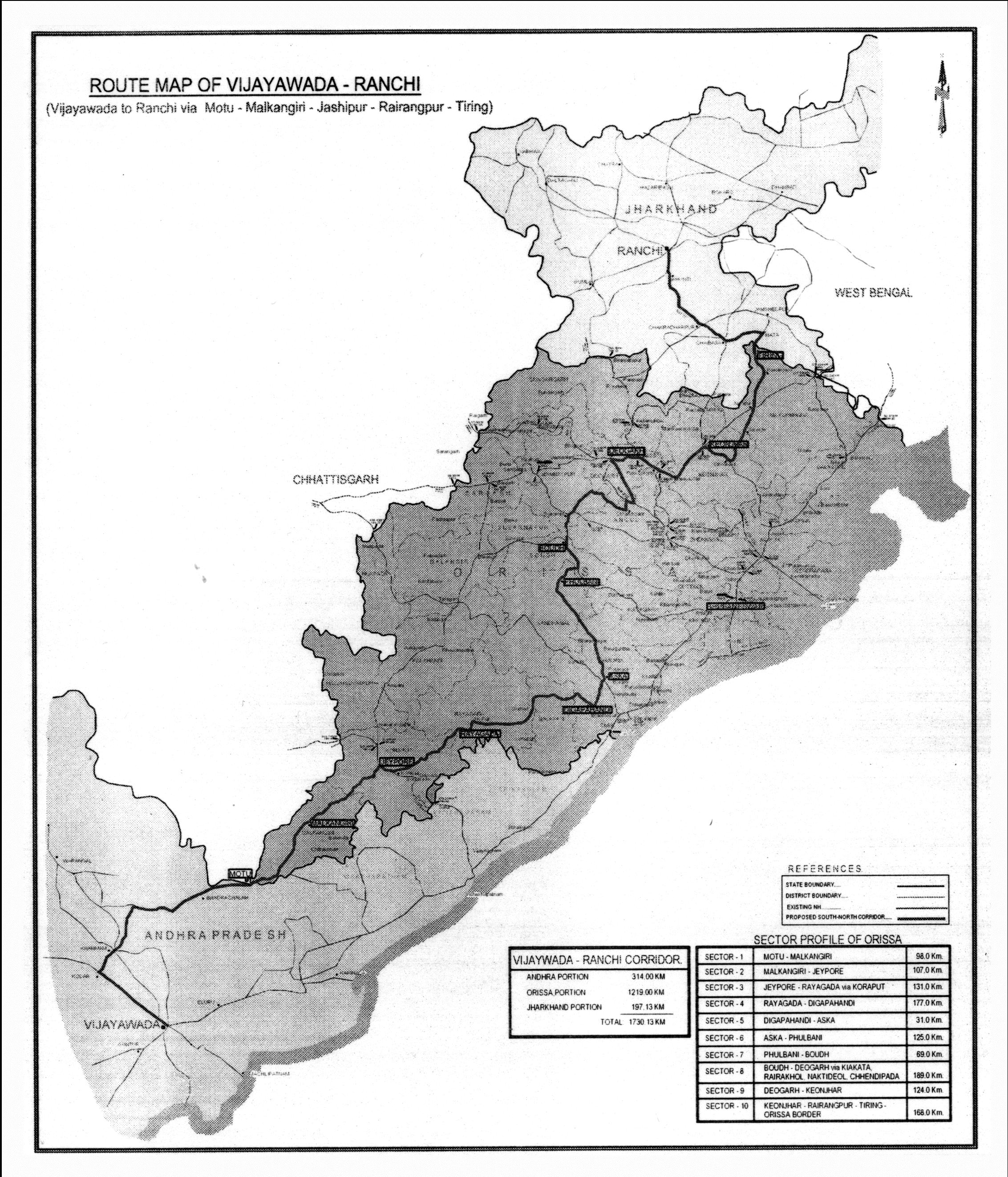
In the following map the blue path is the divided 2 lane Vijaywada-Ranchi highway; the red one, already a 4-lane highway as part of the Golden Quadrilateral will become a 6-lane highway; and the orange (state/PPP funded) and pink (part of NHDP) ones will be 4-lane highways.
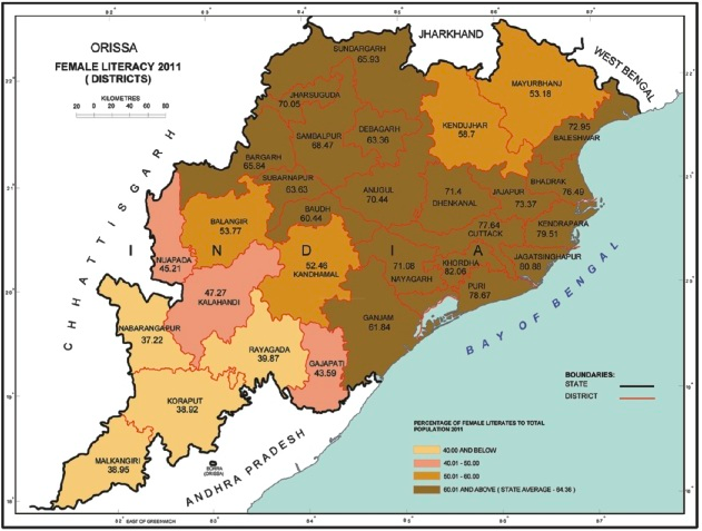
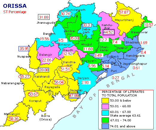
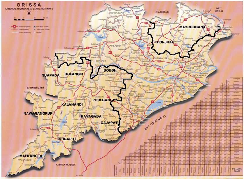
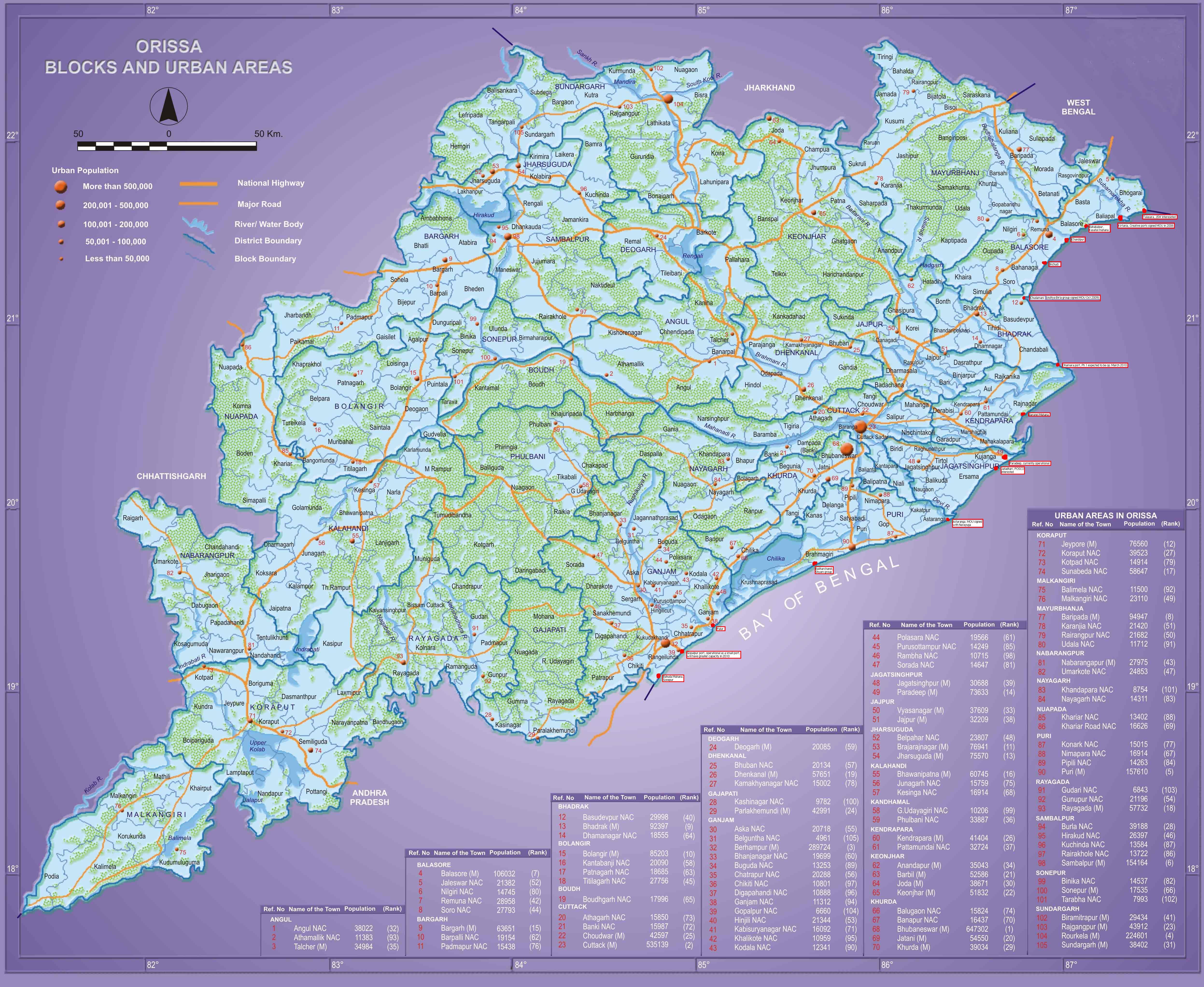
 Based on the above data the backward districts of Odisha are clustered in the north and south as given in the map below.


.jpg)
July 23rd, 2011 at 3:05 am
I beg to differ. How can women literacy of 60% can be the line dividing development from underdevelopment when the national average is 65.46% as far as women literacy is concerned. Practically, any district below the national average should be an underdeveloped one. If one looks at the undivided Ganjam Distrct (excluding Berhampur city) then it is no way better than Bolangir, Koraput or Mayurbhanj and an out and out backward region.
July 23rd, 2011 at 3:09 am
As far as distribution of NHs are concerned, the NH 43 should be taken into account which is in a much better shape than the much hyped Ranchi-Vijaywada Highway which is just on paper.
July 23rd, 2011 at 10:45 am
@Abhisek Do you know if NH 43 is a divided highway or scheduled to be one?
July 24th, 2011 at 11:32 am
NH43 continues to be a 2lane highway and there dont seem to be any plans to 4lane it at all. Its not that busy a highway for it to be 4laned in the present scenario. But road works to expand the ghat sections from single to double lane and also general improvement of road is underway.
July 24th, 2011 at 12:57 pm
The road widening has been chosen mostly based on current and future traffic projections; except the Vijaywada-Ranchi highway, which has some other objectives. So the road work that is going on is an indication of the current and projected economic activities of a region. So unless some steps are taken to address the low economic activities of those regions, they will continue to remain behind.
July 25th, 2011 at 3:14 am
About the NH 43, I meant that at this point it is in a better shape compared to the Ranchi-Vijaywada Highway and its inclusion under NHDP seems more feasible from traffic point of view. Four laning of this is also crucial for development of Koraput and Jeypore areas.
July 25th, 2011 at 9:14 am
@Abhishek
Why do you want to jump straight from a battered 2 lane NH and a barely there single lane state highway to straight 4lane highway. First of all the state govt needs to get the state highways to south Orissa in shape. This will go a long way in helping the development of the region. The NH is already being improved.
Remember, a 4lane highway especially one that traverses mountainous regions will cost a lot of money. As of now, it wont be prudent to make such an investment. Let’s not forget that resources are limited and are to be shared by the whole nation and not just Orissa. Lets be reasonable.