Archive for the 'Jharsuguda-Sambalpur- Bargarh' Category

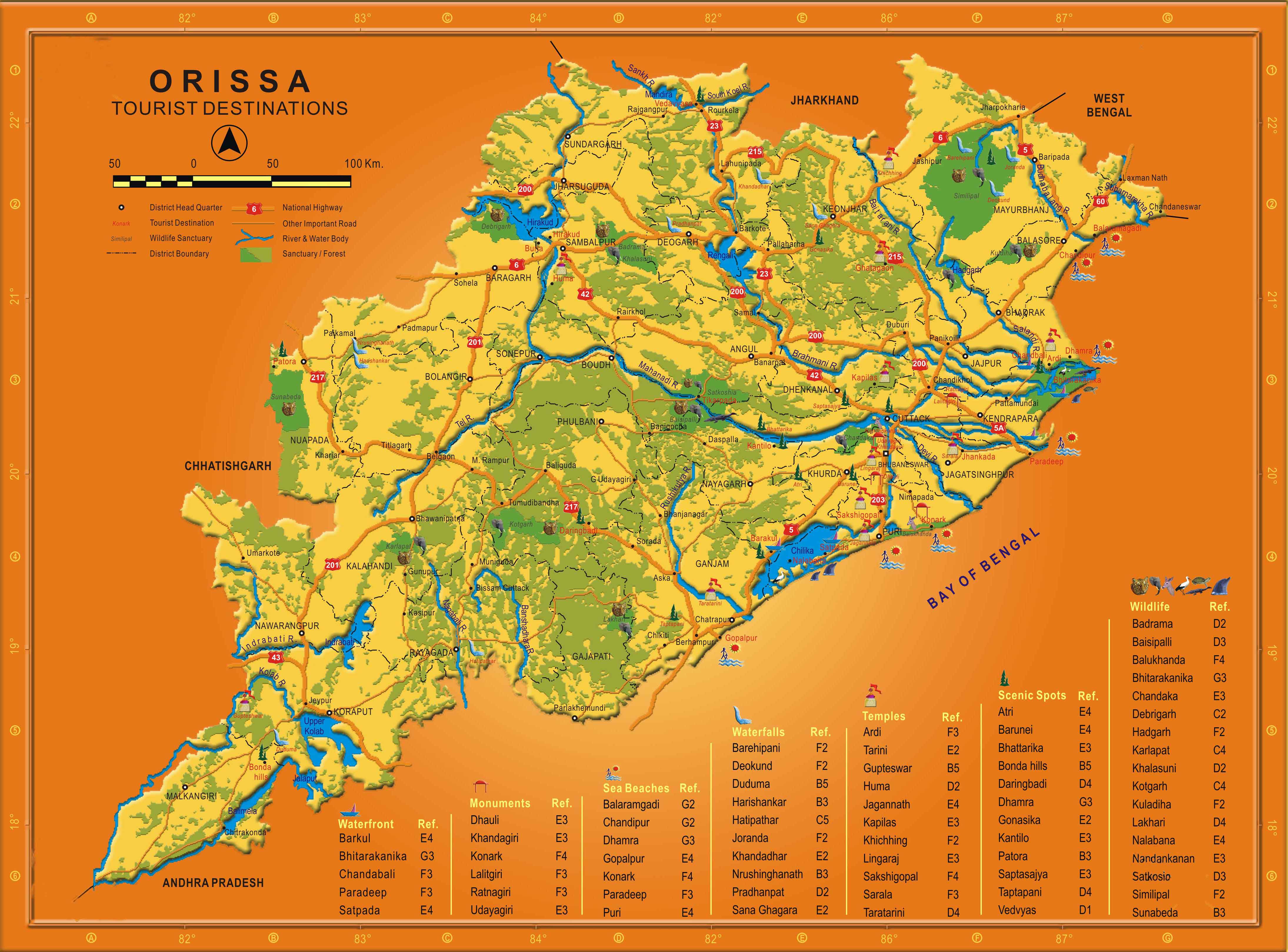
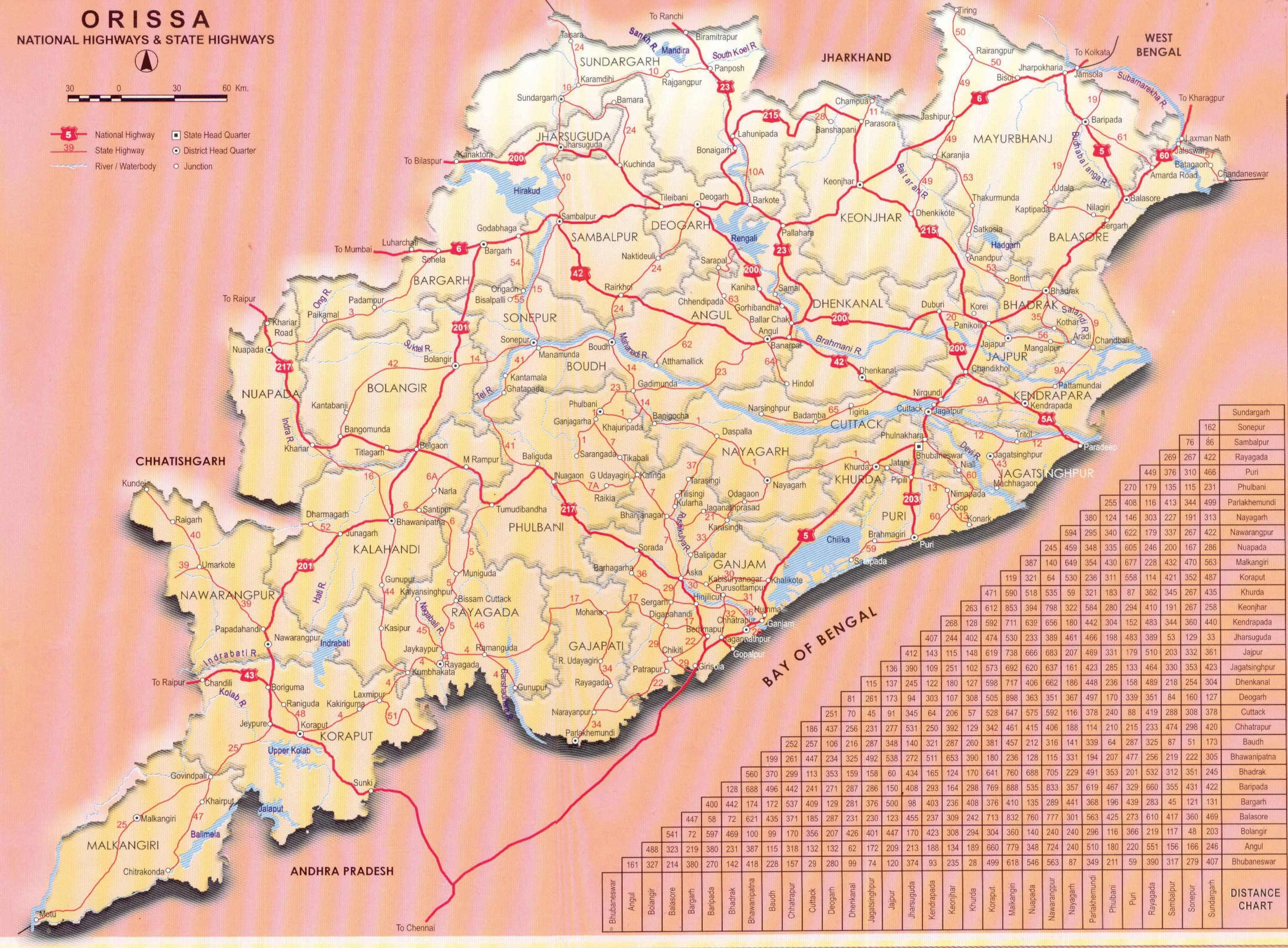
Work starts on Paradeep-Choudwar-Rourkela Industrial Corridor

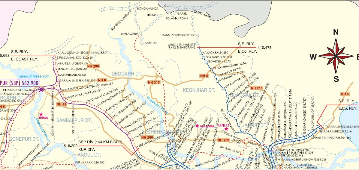
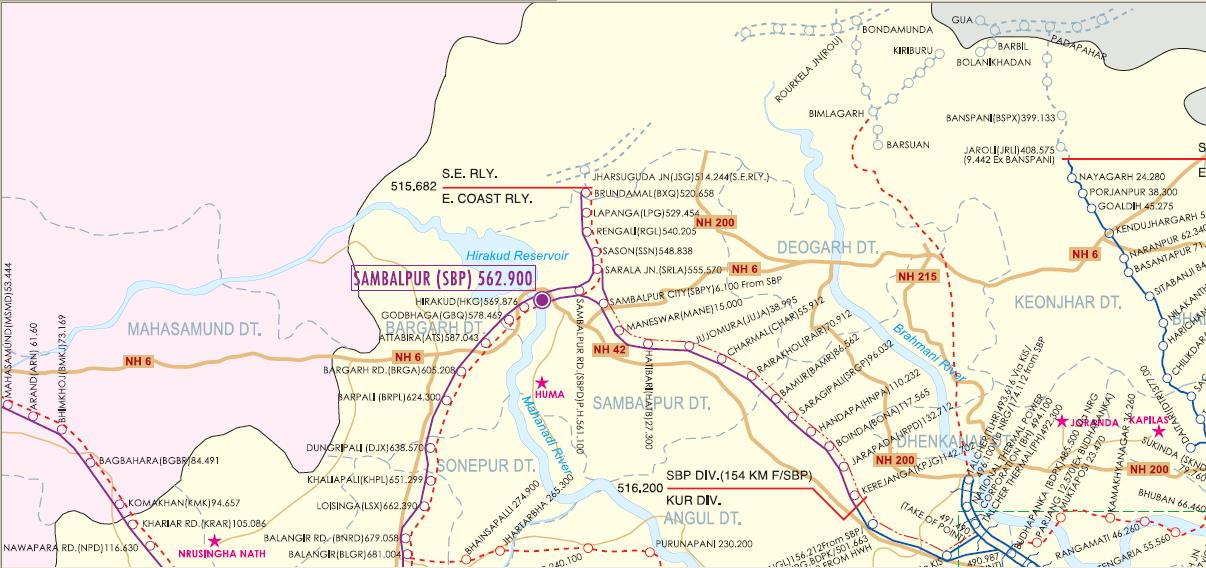
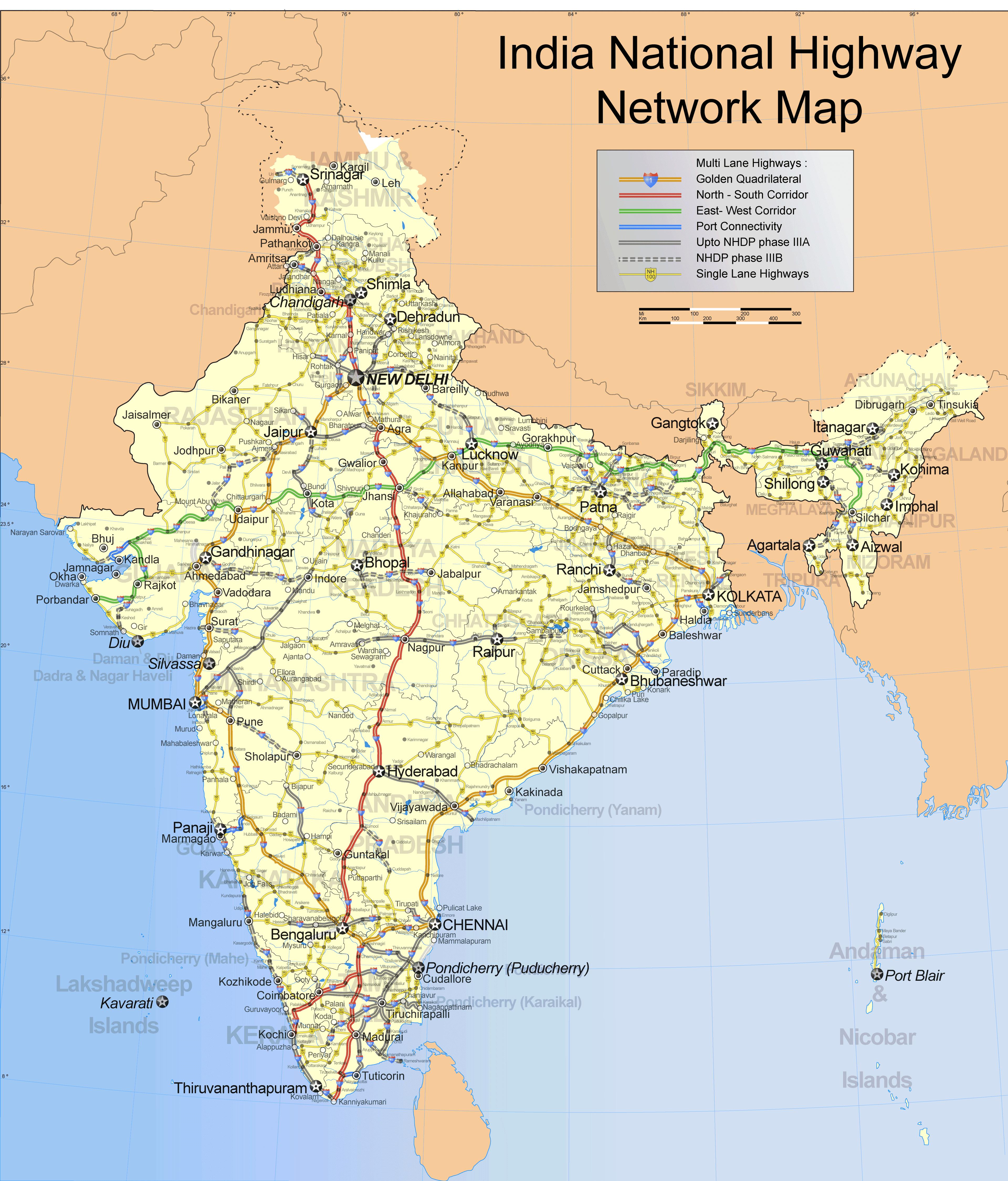
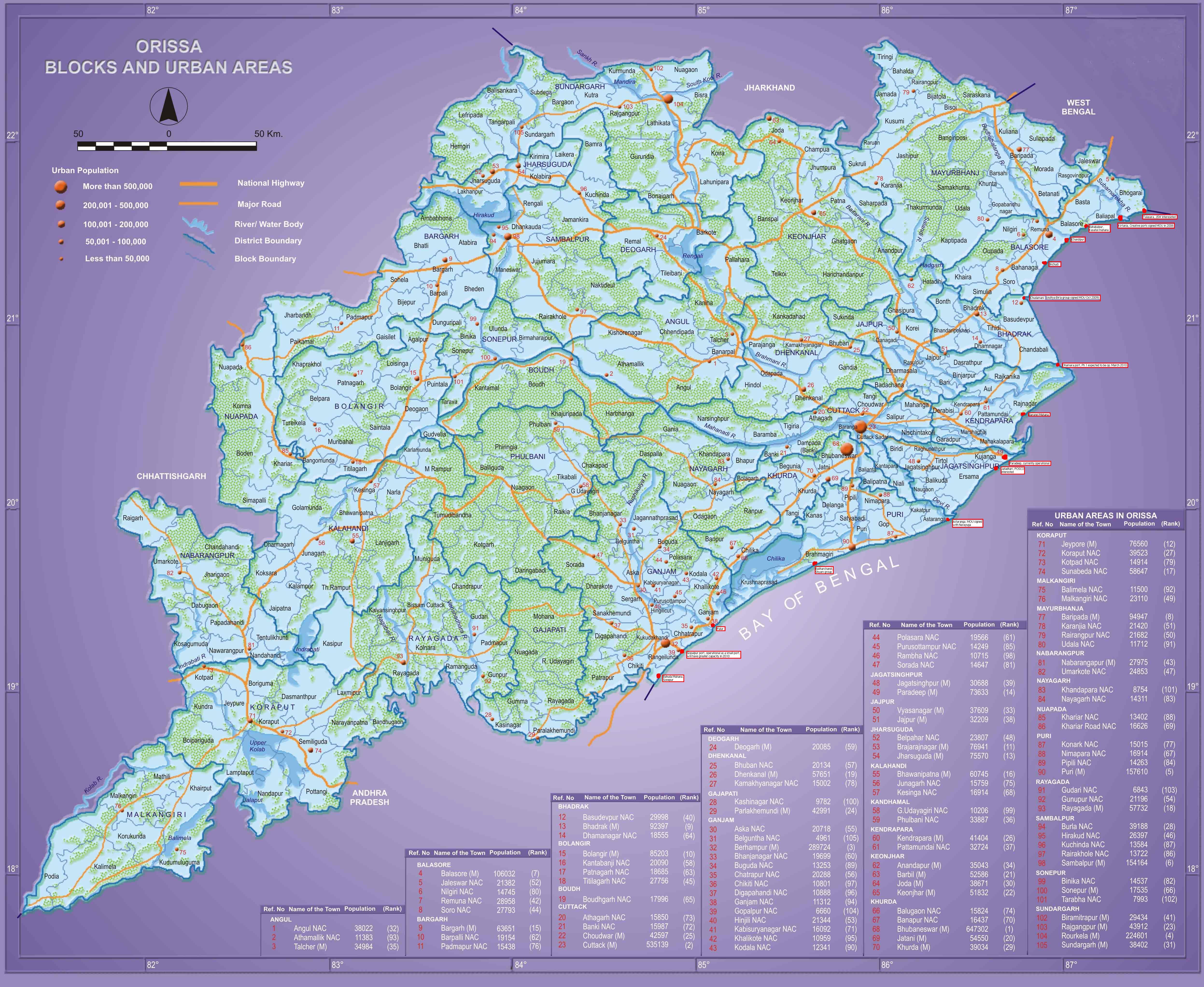
Angul, Anugul- Talcher - Saranga- Nalconagar, Bhubaneswar- Cuttack- Puri, Bhubaneswar-Dhenkanal- Anugul, CKP ... Bhalulata - Rourkela - Jharsuguda Jn - Daghora , Cuttack, Cuttack - Paradeep, Cuttack-Paradip, Dhenkanal, IDCO, Jajpur, Jharsuguda-Sambalpur- Bargarh, Jharsugurha, Jharsugurha- Brajarajnagar- Belpahar, Kendrapada, Khordha, Paradeep port, Paradip - Jatadhari - Kujanga, Rourkela- Kansbahal, Rourkela-Jharsuguda, Sambalpur, Sambalpur - Talcher, Sambalpur-Burla-Jharsuguda, Sambaplur- Burla- Bargarh- Chipilima, Sundergarh, Talcher - Barang, Talcher - Bimlagarh (under constr.) 1 Comment »

Following is an excerpt from a report in ibnlive.com.

The state government has started work on development of a railway corridor through Choudwar to Rourkela to allow ease of inward and outward transportation of goods from the industrial hubs and mining belts along the region.

Land acquisition for the project, the first of its kind initiative by a state government, has already been initiated by the Industrial Infrastructure Development Corporation (Idco). The project would go on ground after the land acquisition and is targeted to be completed by 2015, said Idco CMD Priyabrata Patnaik on Friday.

The corridor involves development of extensive rail and road connectivity, along with provisioning of water supply and other infrastructural facilities. The corridor would encompass two track railway lines and six-lane road passing through the industrial hubs and the coal mining belts. New industrial areas and downstream units would be developed along the corridor.

Common infrastructure facilities under the corridor would solve the problems of inward and outward transportation of goods and minerals. The stretch would pass through the heart of coal mining operations in the state, which harbours about 65 billion tonne of reserves. The coal reserves in the Talcher belt only is around 43 billion tonne.

The corridor would cover 17 large and mega-industries, along with 57 other units, through the stretch from Choudwar to Rourkela. Traffic projection on the route is given out as 8.7 million tonne.

The route would have 163 km of railway track length and 465 km on road. As many as 308 minor bridges and 77 major bridges would have to be constructed on it, said Patnaik.

Note 1: The 163 km of railway track probably refers to the Talcher-Bimlagarh segment.

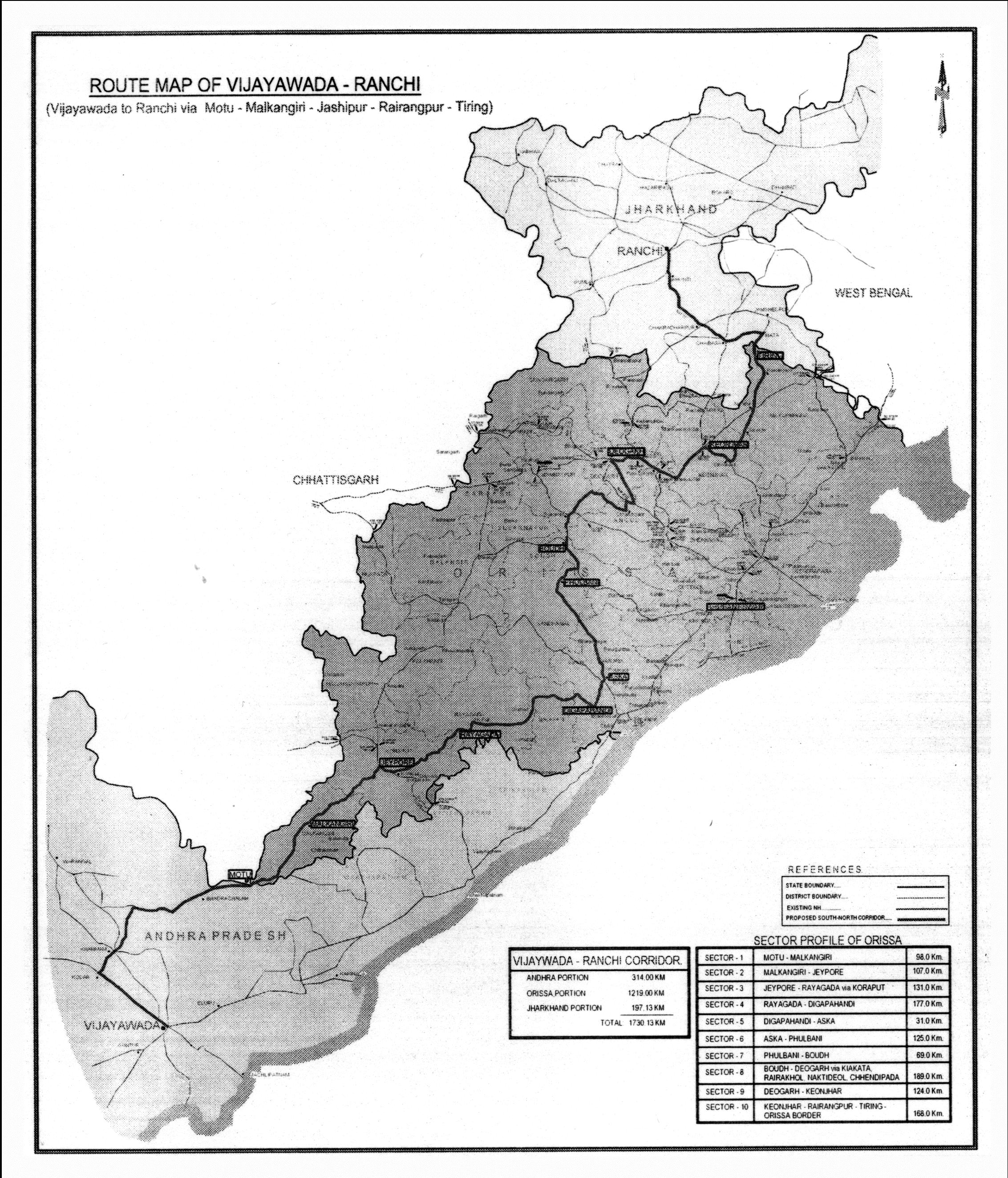
Note 2: Although the above report only mentions the Choudwar-Rourkela part, in earlier documents there is mention of Paradeep-Choudwar-Rourkela industrial corridor. See for example this 2009 Business Standard report. Following are some excerpts from that.

The Orissa government plans to develop an industrial corridor running from Paradeep to Rourkela through industrial hubs like Choudwar, Talcher and Sambalpur.

Though the initial proposal was to have an industrial corridor originating from Choudwar to Rourkela, the proposal was modified to extend the corridor till Paradeep to allow inward and outward transport of goods through the Paradeep port, sources said.

… The proposed industrial corridor will be in line with the Delhi-Mumbai Industrial Corridor and is designed to pass through national highway no.42 and national highway no 5 (A).

Under the project, both road and rail corridor will be developed, which will be the backbone of the proposed project. The industrial estates and down stream units would be developed over 25 km area on both sides of the corridor.

IL&FS has been appointed as the consultant for the project and it has already submitted the pre-feasibility study report to the industry department on the project. However, the detail cost of the project is yet to be worked out yet, sources added.

The latest initiative of the state government follows a similar initiative to develop a common ‘rail-road-water pipeline and infrastructure corridor’ in Meramundali-Angul-Talcher-Chhendipada belt, to facilitate movement of coal in the Talcher coalfield area.

The project is estimated to cost about Rs 5000 crore including Rs 2000 crore for 2-line rail corridor and Rs 1100 crore for 4 lane road alongside it. The land width of the proposed corridor will be 300 metre which includes 60 metre for road and 20 metre for water pipeline.

The total length of the corridor is 137 kilometre which includes length of 43 number of major bridges to be constructed on this stretch. RITES Ltd has already submitted a pre-feasibility report to the state owned Industrial Infrastructure Development Corporation of Orissa Ltd. (Idco) on the project.

The project is designed to have multi-point centralised loading stations conceived along the corridor rather than individual bulb connections with a view to avoid interference or wastage of coal bearing areas. Road and water pipe alignment will run parallel to rail alignment, sources said.

It will be connected to rail line at three locations- Jharpada, Angul and Budhapanka. The common corridor will have multiple entry and exit points and no surface crossing. Besides, flyovers are proposed to avoid cross movements at junction stations.

This ‘rail-road-water pipeline and infrastructure corridor’ in Meramundali-Angul-Talcher-Chhendipada belt is projected to handle 113 million tonne coal by 2014-15. It includes 55 million tonne coal movement required by the power companies, 40.76 million tonne by steel companies and 17.22 million tonne by other industries.

Railways in North and Northwest Orissa

Angul, Angul - Talcher - Sukinda (under constr.), Balasore, Bargarh, Bhadrakh, Bouda, Deogarh, ECOR, Jakhapura - Daitari, Jharsuguda-Sambalpur- Bargarh, Jharsugurha, Keonjhar, Mayurbhanj, Railway maps, Rourkela-Jharsuguda, Sambalpur, Sambalpur - Talcher, SER, Sonepur, Sundergarh, Talcher - Bimlagarh (under constr.), Titlagarh - Jharsugurha Jn, Tomka - Jaroli Comments Off on Railways in North and Northwest Orissa

ecor-status-april1-2007-north-orissa.JPGecor-status-april1-2007-northwest-orissa.JPG

Drinking Water project for Jharsugurha, Belpahara and Barajarajnagar area

Drinking water projects, Jharsuguda-Sambalpur- Bargarh, Jharsugurha, Jharsugurha- Brajarajnagar- Belpahar Comments Off on Drinking Water project for Jharsugurha, Belpahara and Barajarajnagar area

The project will use water from the Ib river. Following is Samaja’s article on this.

20070810a_001101009water.jpg
20070810a_002101007ib2.jpg

Alcan sells Utkal Alumina stake to Aditya Birla group’s Hindalco

Aluminium, Bauxite, Birlas, Jharsuguda-Sambalpur- Bargarh, Jharsugurha, Rourkela-Jharsuguda 4 Comments »

Business Standard reports on this. Following are some excerpts.

Canadian metal giant Alcan today announced an agreement to sell its 45 per cent stake in Utkal Alumina to the Aditya Birla group’s Hindalco Industries for an undisclosed sum.

The Utkal joint venture was established in 1992 between the Birlas and Alcan, with the Birlas owning the remaining 55 per cent of the equity. The venture involved the development of a new bauxite mine and alumina refinery in Orissa. …

“Alcan will have no surviving rights or obligations as Hindalco becomes the 100 per cent owner of the Utkal project,” it said. The Indian company expects the deal to be closed in the next 30 days. …

The project has been marred by controversy, with local residents opposing its construction on the plea that it will displace three villages and at least 200 families. Local critics have estimated that as many as 22,000 people could be affected. In December 2000, there was a clash between villagers and police in Maikanch over land acquisition. Three tribals were killed in the police firing that followed. Utkal was initially established as a joint venture between Hindalco, Alcan and Hydro Norsk. The shareholding was shared between Indal, now a part of Hindalco at 20 per cent; Alcan at 35 per cent and Norsk Hydro with 45 per cent. Norsk Hydro later sold its stake to the other two partners.

30 Infrastructure projects with PPP funding in Orissa

Angul, Bhubaneswar- Cuttack- Puri, Bhubaneswar-Paradip, Dhenkanal, Jagatsinghpur, Jajpur, Jharsuguda-Sambalpur- Bargarh, Khordha, PPP, Railways, Rayagada, Roads, highways and Bus stands, Rourkela-Jharsuguda, Sambalpur, SEZs, Sundergarh 3 Comments »

Business Standard in an article in April listed several infrastructure related projects that Orissa is planning using PPP. Following are excerpts from that article.

… the Orissa government has lined up 18 new projects in the Public Private Partnership (PPP) mode entailing an investment of over Rs 6000 crore.

Of the 18 projects, 12, mostly large and medium, have already been consolidated with investments of Rs 3500 crore.

Another six projects, fairly bigger in respect to the previous ones, are under active consideration and would cover an investment of around Rs 2500 crore, according to government sources.

Source said, till date, an around Rs 5300 crore investments have already been lined up and are under implementation in the PPP module in 12 odd projects across the state.

In all the Orissa government plans to develop 30 odd projects in different sectors in the PPP module over the next two years covering an investment of over Rs 11,300 crore. …

The PPP modules currently under implementation and those under consideration cover a wide range of activities starting from port cuilding, railway line construction, road development and erection of urban clusters. …

The new projects being considered under the PPP module included development of road links in the Capital Region Ring Road, the Bhubaneswar-Paradip Road, the Suakati-Dubuna Road and the Tensa-Barsuan-Lahunipada Road.

These would entail a primary investment of Rs 1547 crore for the development of 279 kilometres of road, including a four-laning of the first one.

Other than this there would World Bank identified projects where four laning would be done of the Sambalpur-Rourkela road from the existing two-lane road.

The long pending Joda-Bamebari Road and Koira-Rajamunda Road covering 229 kilometres would also be taken up.

The PPP module would be used for two vital rail links. The first was the Angul-Duburi-Sukinda rail link and the second the Gunupur-Theruvali link. In both cases, the Special Purpose Vehicle ( SPV) route was being proposed. The investment for the rail links was estimated to be in the region of Rs 570 crore. The Angul-Sukinda rail link would be of 90 kilometres and the Gunupur-Theruvali link would be 79 kilometres.

PPP’s for setting up Bio-tech parks, SEZ for IT/ITES companies and integrated commercial and residential complex, an enclave at Shahidnagar are were also part of the city building endeavour of the Orissa government.

This apart, a commercial shopping complex and an A.C.Market complex at Unit IV are also being contemplated in the PPP mode as part of city development plan.

Till date, investment for the SEZ for IT/ITES companies had been identified and were estimated to be in the region of Rs 35.67 crore. As for the other residential and commercial complexes, project details and cost were being worked out on a war footing.

Coupled with these, a multi-product SEZ at Paradeep had been suggested by the government for development using the PPP route. It was expected to entail an investment of Rs 712 crore.

Land of around 1093 hectares would be needed for the SEZ in the Marshagahi Tehsil of Kendrapara under Paradeep.

This article is probably based on a presentation available from the Orissa govt. website. That file seems to be corrupt but its google cache shows part of the information.

Infrastructure of Sambalpur-Burla-Baragarh-Chipilima cluster: a dated compilation

Bargarh, Jharsuguda-Sambalpur- Bargarh, Rourkela-Jharsuguda, Sambalpur, Sambaplur- Burla- Bargarh- Chipilima Comments Off on Infrastructure of Sambalpur-Burla-Baragarh-Chipilima cluster: a dated compilation

Infrastructure of Sambalpur-Burla-Baragarh-Chipilima cluster, Orissa

Educational and research infrastructure of Orissa

City Guides in the net.

Universities in Sambalpur area.

  • Sambalpur University, Burla, Sambalpur
  • College of Agriculture, OUAT, Chiplima, Sambalpur B.Sc.(Ag.)

Research institutes in Sambalpur area.

Medical/Dental Colleges in Sambalpur area.

Management Institutes (granting MBA or equivalent) in Sambalpur area

  • Department of Business Administration, Sambalpur University, University Campus, Jyothi Vihar Building, Burla – 768 019 Dist: Sambalpur
  • Gangadhar Meher College (Autonomous) Sambalpur-04, Sambalpur, Orissa

Engineering Colleges in Sambalpur area

  • University College Of Engg. Burla, P.O. Engg. College, Sambalpur – 768 018.
  • Padmashree Kurtartha Acharya College Of Engg At/Po Chakarkend-768028 Dist Bargarh Orissa

MCA granting institutions in Sambalpur area

  • Gangadhar Meher College, Sambalpur – 7658 004 Dist: Sambalpur
  • University College of Engineering, Burla – 768 018 Dist: Sambalpur

Pharmacy schools in Sambalpur area

  • Gayatri College Of Pharmacy Gayatri Vihar, Jamadarpali,,Sambalpur – 768 101.

Autonomous Colleges with Masters programs in Sambalpur area

  • Gangadhar Meher College Sambalpur, Dist. Sambalpur – 768 004
  • University College of Engg. Burla (Sambalpur), Orissa – 768 018

Other institutions with non traditional (i.e., beyond Science/liberal Arts/Commerce/Engg/Medical/MBA etc.) programs

  • Govt. College Physical Education, Kuksari, Sambalpur
  • Jagannath Sanskrit college, Bijayapalli, Baragarh
  • Lajpat Rai Law College, SAMBALPUR
  • Orissa Medical College of Homeopathy and Res., SAMBALPUR
  • Sri Nrusinghanath Ayruved College, Research Institute, PAIKMAL. Bargarh

Fun/Culture/Tourism in and around Sambalpur area

Industries and Industrial infrastructure in and Around Sambalpur area

Getting to/from Sambalpur area

Roads and Highways infrastructure in Orissa

Angul, Balangir, Balasore, Bargarh, Baripada-Balasore-Kirtania, Bhadrakh, Bhadrakh-Balasore, Bhadrakh-Dhamara, Bhubaneswar-Berhampur, Bhubaneswar-Cuttack- Kalinganagar, Bhubaneswar-Dhenkanal- Anugul, Bhubaneswar-Nayagarh, Bhubaneswar-Paradip, Bhubaneswar-Pipli- Astaranga, Bhubaneswar-Pipli- Konark, Bhubaneswar-Puri, Bouda, Choudwar-Kendrapara - Dhamara, Coastal highway, Corridors emanating from Bhubaneswar metro, Cuttack, Cuttack-Paradip, Deogarh, Dhenkanal, DISTRICTS & BLOCKS, Gajapati, Ganjam, Grama sadak, Jagatsinghpur, Jajpur, Jharsuguda-Sambalpur- Bargarh, Jharsugurha, Kalahandi, Kalinganagar - Kamkhya Nagar - Talcher, Kalinganagar - Panikoili - Jajpur - Kendrapara, Kalinganagar - Tarini - Keonjhar, Kalinganagar- Chandikhol- Paradip, Kalinganagar-Bhadrakh, Kandhamala, Kendrapada, Keonjhar, Khordha, Koraput, Malkangiri, Mayurbhanj, Mining Corridor, Nabarangpur, National Highways, Nayagarha, NH 200 (440 Kms: Chhattisgarh - Jharsuguda - Deogarh - Talcher - Kamakhyanagar - Duburi - Chandhikhol), NH 201 (310 Kms: Boriguma - Bhawanipatna - Balangir - Bargarh), NH 203 (97 Kms: Bhubaneshwar-Pipili-Puri-Konark), NH 203A (49 Kms: Puri - Bramhagiri - Satpada), NH 215 (348 Kms: NH-5@Panikoli - Anandapur - Kendujhargarh -Rajamundra @NH-23), NH 217 (438 Kms: Chhattisgarh Border - Khariar Rd - Nuapada - Khariar - Titlagarh - Ramapur - Baligurha - Asika - Brahmapur - Gopalpur), NH 224 (298 Kms: Khordha - Nayagarh - Dashapalla - Bauda - Sonapur - Balangir), NH 23 (209 Kms: Jharkhand Border - Rourkela - Rajamundra - Pala Laharha - Talcher - NH-42), NH 42 (261 Kms: NH-6@Sambalpur - Redhakhol - Anugul - Dhenkanal - NH-5@Nergundi), NH 43 (152 Kms: Chhattisgarh Border - Chandili - Borigma - Jaypur - Koraput - Sunki - Andhra Pradesh Border), NH 5 (488 kms: NH No.6 in Jharkhand - Baripada - Baleshwar - Bhadrakh - Cuttack - Bhubaneswar - Khordha - Brahmapur - upto Andhra Pradesh Border), NH 5A (77 Kms: NH-5 at Chandikhol to Paradip), NH 6 (462 Kms: Chhattisgarh Border - Lobarchatti - Bargarh - Sambalpur - Deogarh - Kendujhargarh - Jashipur - Bangriposi - Jharkhand Border ), NH 60 (57 Kms: West Bengal Border- Jaleswar - Baleshwar), NH 75 (18 Kms: Jharkhand Border to NH-215 near Parsora), Nuapada, Overall Odisha, Puri, Puri - Konark, Rayagada, Road maps, Roads, highways and Bus stands, Rourkela-Jharsuguda, Sambalpur, Sonepur, State highways, Sundergarh, Vijaywada-Ranchi highway Comments Off on Roads and Highways infrastructure in Orissa


In recent years there has been a big jump in the number of kilometers of national highways in Orissa. Following is copied from my page "Roads and Highways infrastructure in Orissa."

Road network: Orissa Roads1; Orissa Roads2; India’s NH network; India’s golden quadrilateral; the part of the GQ/NH-5 that runs through Orissa.

  • National Highways in Orissa and India; its growth in recent years:
    • NH 5: Junction with NH No.6 in Jharkhand near Baharagora-BaripadaBaleshwar-Bhadrakh-Cuttack- Bhubaneswar-Khordha-Chhatrapur-Brahmapur– upto Andhra Pradesh Border. (488 kms)
    • NH 5A: Junction with NH No.5 near Haridaspur-Paradip Port. (77 kms)
    • NH 6: From Chhattisgarh Border-Lobarchatti- BargarhSambalpur-Deogarh-Barakot- Kendujhargarh -Jashipur-Bangriposi-upto Jharkhand Border (462 kms)
    • NH 23: From Jharkhand Border-Panposh-Raurkela– Rajamundra-Barakot- Pala Laharha-Talcher-Jn. with NH-42 (209 kms)
    • NH 42: Junction with NH No.6 near Sambalpur– Redhakhol-Anugul-Dhenkanal- Jn. with NH-5 near Cuttack. (261 kms)
    • NH 43: From Chhattisgarh Border– Dhanpunji- Borigma- JaypurKoraput-Sunki- Andhra Pradesh Border. (152 kms)
    • NH 60: From West Bengal BorderJaleswarBaleshwar (57 kms)
    • NH 75: From Jharkhand Border to junction with NH No.215 near Parsora (18 kms)
    • NH 200: From Chhattisgarh-Machida-Jharsuguda– Kochinda- Deogarh –Talcher-Kamakhyanagar-Sukinda- Chandhikhol (440 kms)
    • NH 201: Boriguma-Ampani-Bhawanipatna– Belgan- Balangir-Luisinga-Jogisuruda-Dunguripali-Bargarh (310 kms)
    • NH 203: Bhubaneshwar-Pipili-PuriKonark (97 kms)
    • NH 203A: The highway starting from its junction with NH-203 at Puri, connecting Bramhagiri and terminating at Satpada (49 kms)
    • NH 215: Panikoli-Anandapur-Ghatgan- Kendujhargarh– Parsora-Koira-Rajamundra (348 kms)
    • NH 217: From Chhattisgarh Border-Nauparha-Khariar- Titlagarh-Belgan- Ramapur- Baligurha-Sorada-Asika- Brahmapur– Narendrapur- Gopalpur (438 kms)
    • NH 224: Khordha-Nayagarh-Dashapalla- Purunakatak-Bauda-Sonapur-Balangir (298 kms)
  • Vijaywada-Ranchi highway (approved by planning commission as reported in May 2006), [July 06] [The Orissa government has been demanding a NH from Vijaywada to Ranchi which will pass through the Naxal infested areas. 1200 km of this 2000km will be in Orissa. CM talked to planning comission about it.]
  • Ongoing National Highway work in Orissa
  • Future plans for Orissa: [1:april-28-05]; [2:april-28-05].
  • Various phases of NHDP: [1]; [2]; [3]
  • Other highway plans:
    • 4 laning of Chandikhol-Paradip by February-end of 2007
    • 4 laning of Keonjhar-Panikoili, Duburi-Talcher, Cuttack-Paradeep and Duburi-Keonjhar Highways. [June17-05-Pragativadi]
  • Aim-for-with-high-priority/parts-of-it-in-Orissa-govt- plan(page4)-already:
    • Connect NH 215 (perhaps at Jajpur Rd) to Jenapur to NH200 (where it meets Brahmani) with a highway as Jenapur is the location where the National waterway will cross the railway line and Jenapur is 7 kms from where a branch of the line goes to Daitari and Bansapani.
    • Designate AP-border-Koraput-Raygada-Padampur- Berhampur (in NH5) as a National highway. (This will bring Koraput and Raygada, thus a big part of KBK, closer to BBSR) — a slight revision of what is in the plan
    • Designate Anandpur (NH 215)-Bhadrak-Dhamara port as an NH. (This will bring Dhamara port closer to Jharkhand, thus helping industries in Jharkhand and Orissa.)
    • Jagatpur-Kendrapara-Chandbali-Dhamara — make it an NH (alternative route to Dhamara port)
    • Panikoili/Kuakhia-Jajpur-Aradi-Chandabali — make it an NH (alternative route to Dhamara port)
    • Panikoili-Jajpur-Kendrapara-NH5a-Paradeep — make it an NH (alternative to Paradeep port)
  • Orissa State Road Transport Company (OSRTC)
  • Wide city roads:
    • Four-laning of the Airport-Dhamana Chhaka road in Bhubaneswar: [1]
    • Other Bhubaneswar Road plans: [1], [2]
  • Bhubaneswar area road plans: