Archive for the 'NH 203A (49 Kms: Puri – Bramhagiri – Satpada)' Category

Major four laning and infrastructure building initiative in Puri for 2015 Nabakalebar

Bhubaneswar- Cuttack- Puri, NH 203 (97 Kms: Bhubaneshwar-Pipili-Puri-Konark), NH 203A (49 Kms: Puri - Bramhagiri - Satpada), Odisha govt. action, Orissa State Road Project, Puri, State highways Comments Off on Major four laning and infrastructure building initiative in Puri for 2015 Nabakalebar

Following are excerpts from a report in tathya.in.

… The first preparatory meet for Nabakalebara was chaired by Chief Minister, was attended by P K Mohapatra, RDC, U N Behera Principal Secretary Home, Aditya Prasad Padhi Principal Secretary to CM.

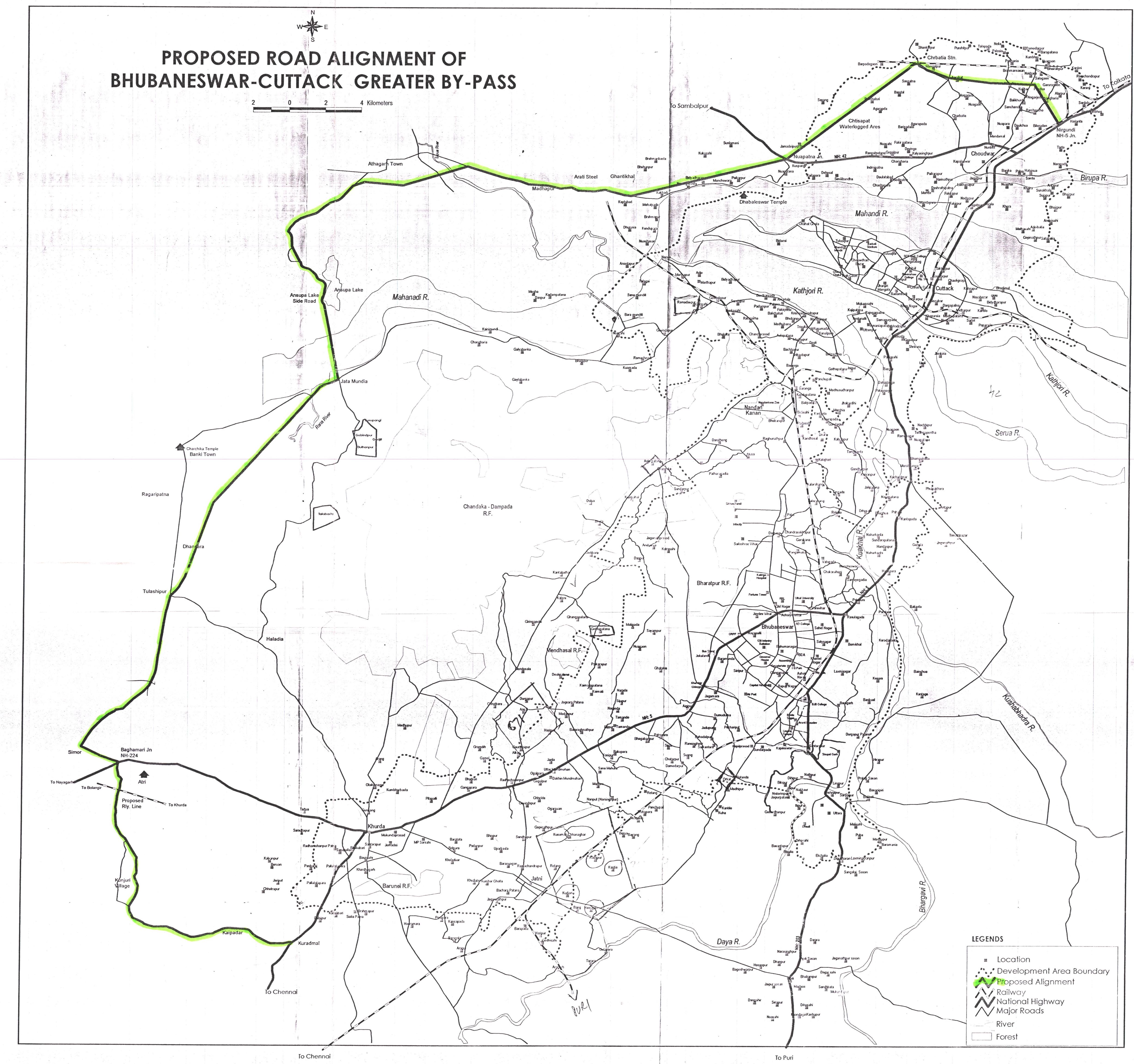
… A Four Lane National Highway is progressing from Bhubaneswar (Rasulgarh) to Puri (Sipasarubali) with almost half the road will be new alignment. 

Meeting decided to approach National Highway Authority of India(NHAI) to develop Four Lanning of Puri-Konark and Puri-Satapada Road. 

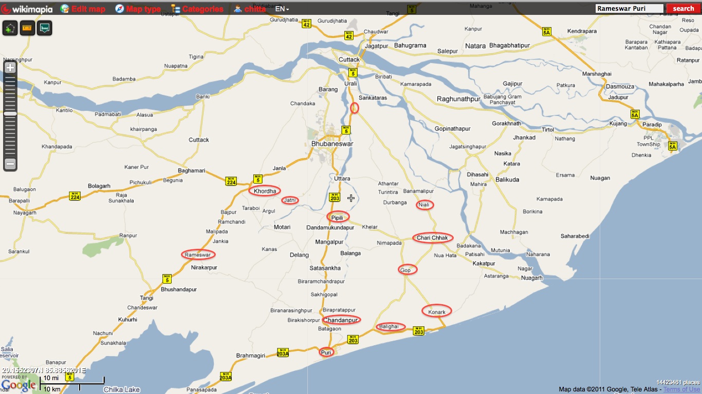
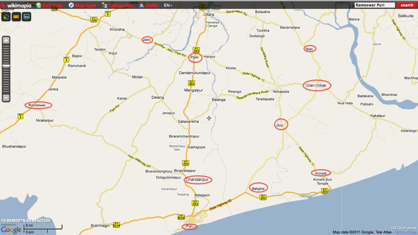
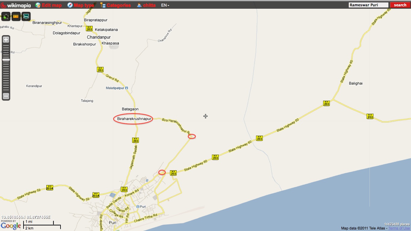
Secondly at least seven roads will be taken up for Four Lanning, which include Pipili-Konark, Charichhak-Niali-Phulanakhara, Balighai-Gop, Pipili-Jatnai, Chandanpur-Rameswar, Bira Harekrishnapur-Talabania and Bira Harekrishnapur-Rahangiria Roads.

… There is a need for creating more hotel and lodging rooms, for which appropriate Government land has to be provided to the promoters adopting transparent procedure.

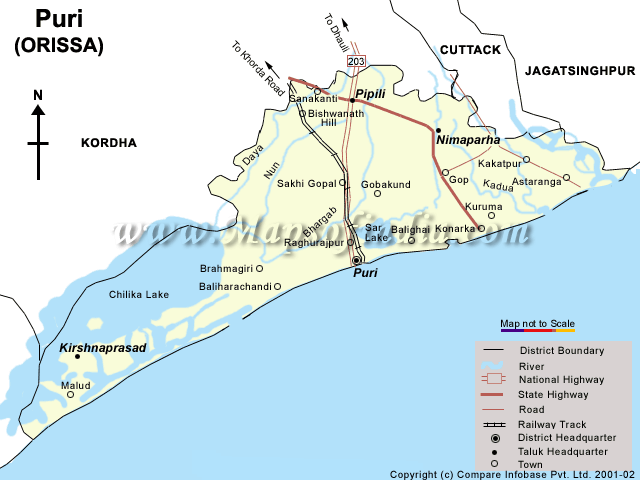
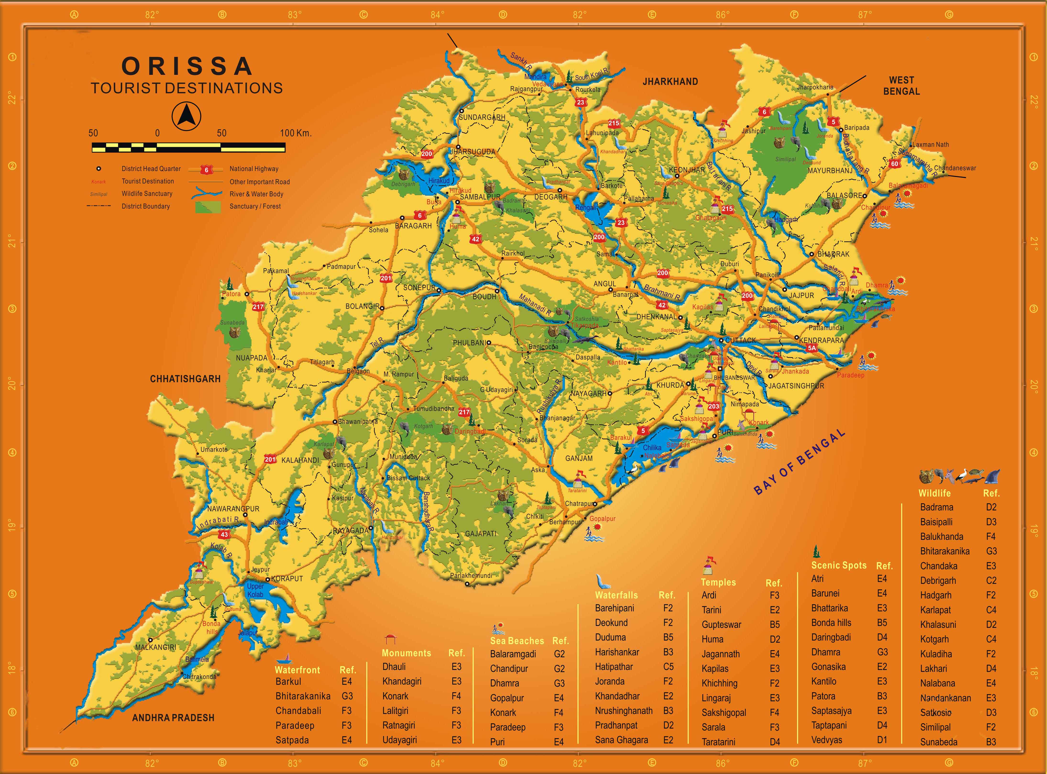
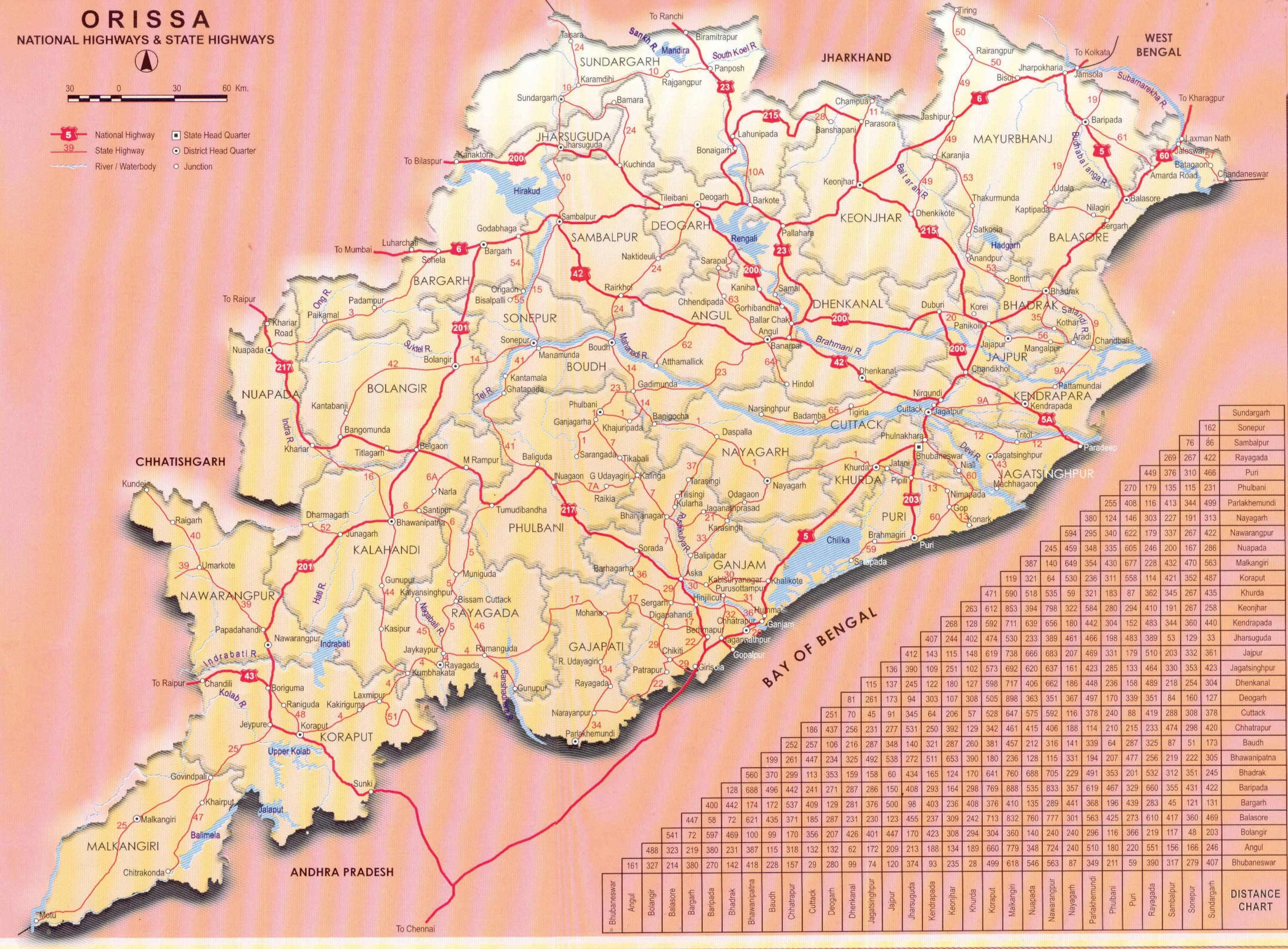
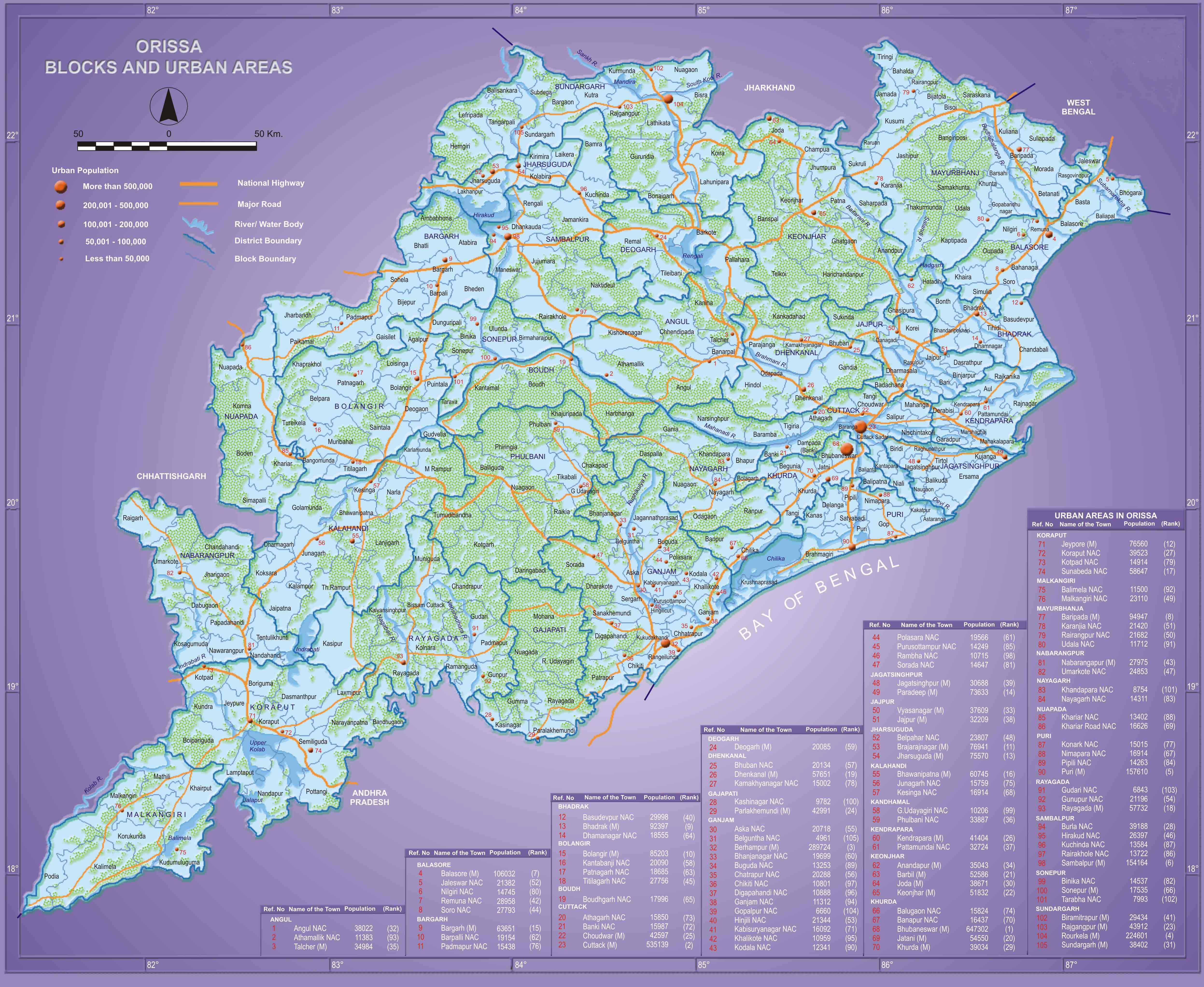
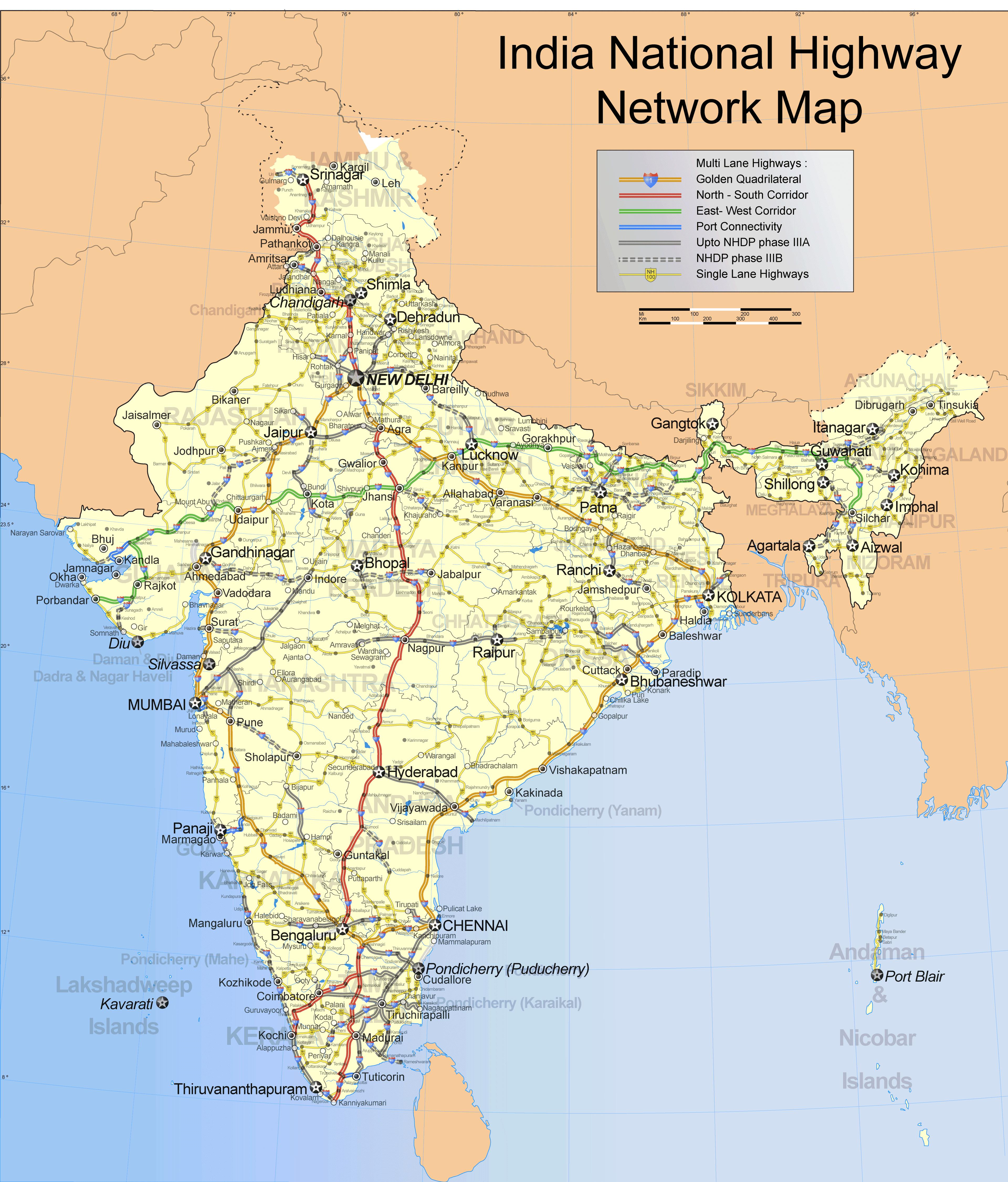
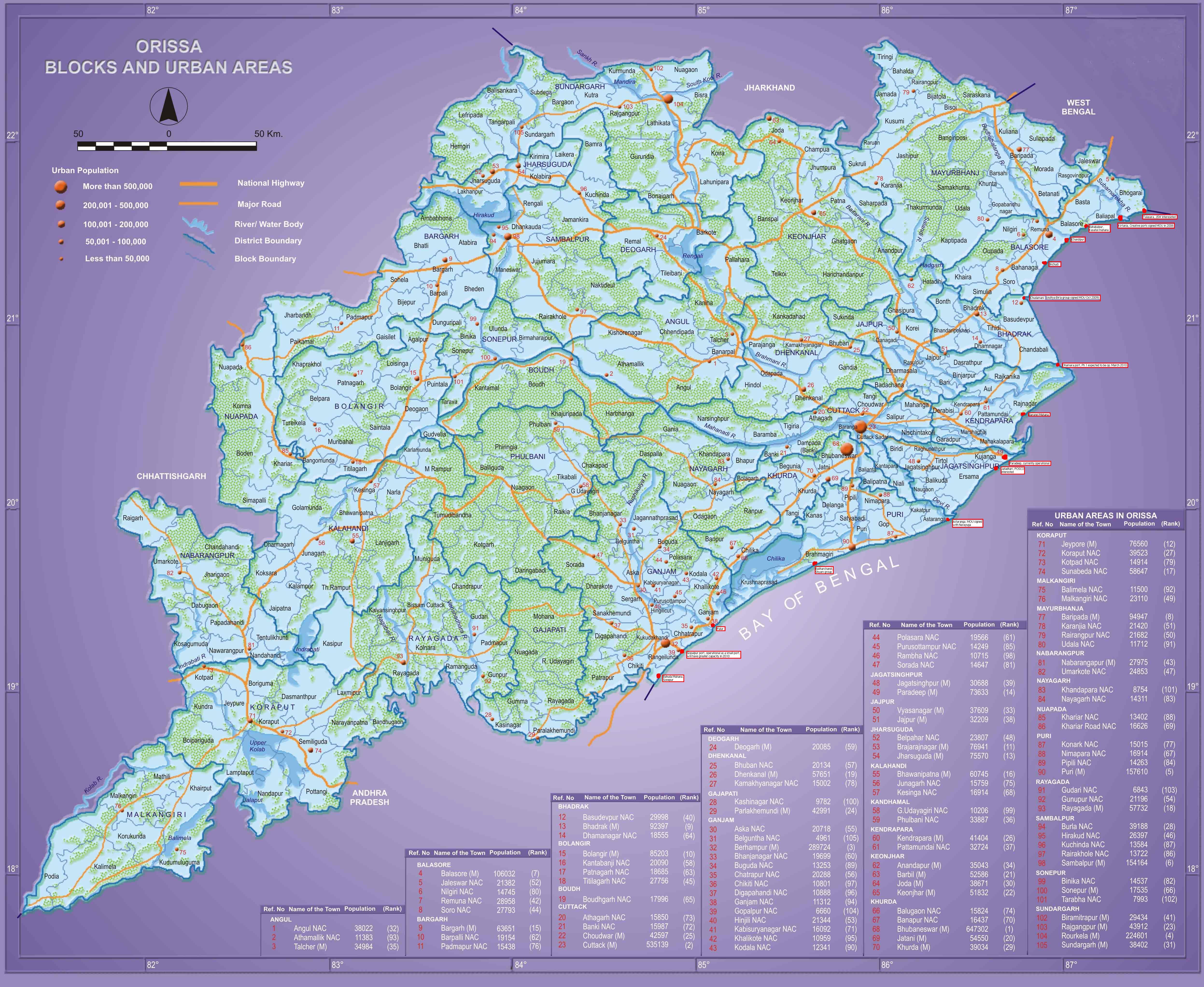
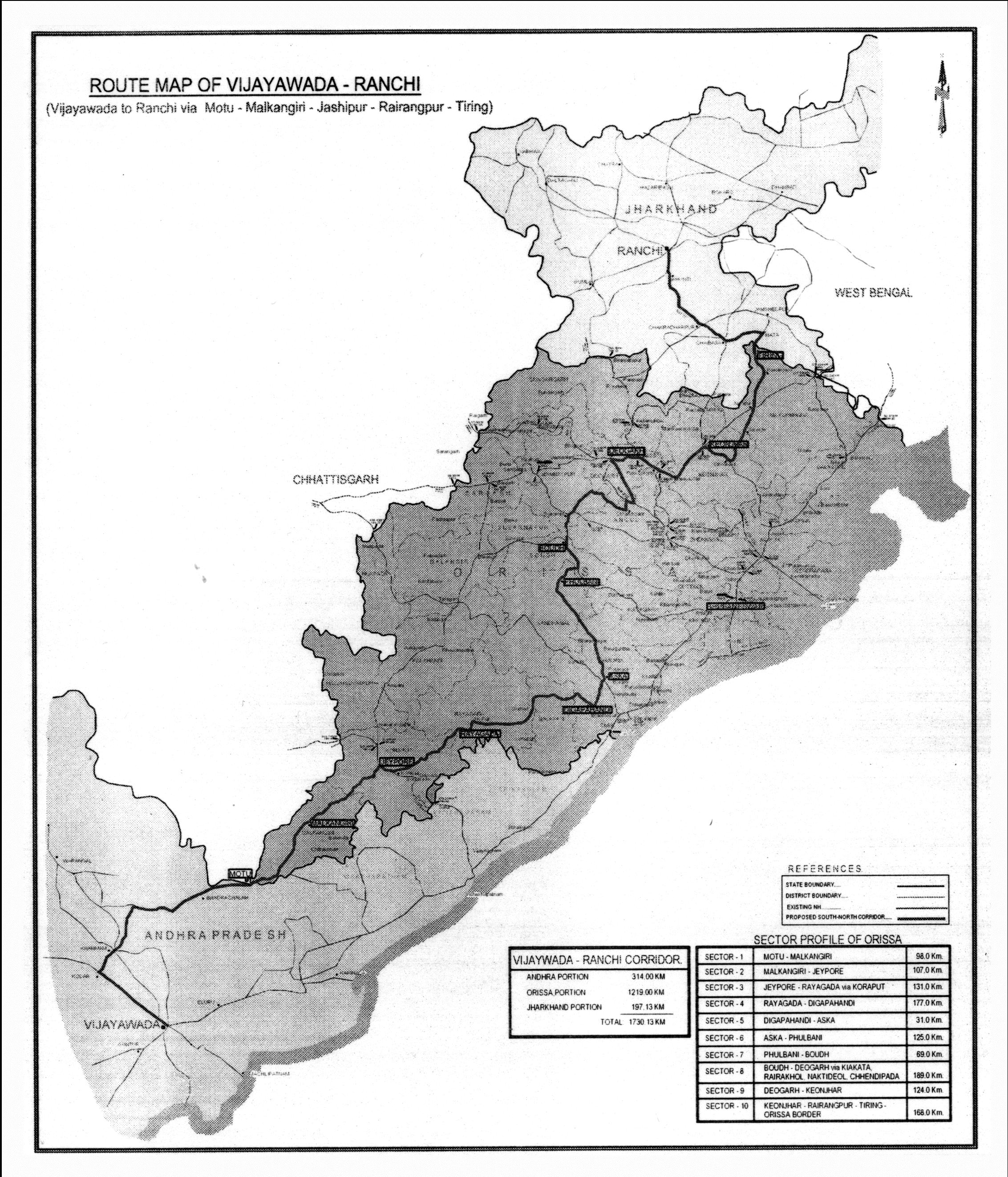
The following maps show the location of some of the names mentioned above.

One interesting point to note is that Puri district’s area is 3,479 sq. km, which is comparable to Goa’s 3,702 sq km. Population wise they are also comparable. Goa’s population is 1.4 million while Puri district’s population is about 1.5 million.

Past the Nabakalebar in 2015, the Odisha government may think of building up on the infrastructure and try to benchmark Puri district with respect to Goa. It may also consider to make it a special district with some special laws that will allow it the flexibility to become as big a tourist hub (or bigger) than Goa, minus the negatives.

Roads and Highways infrastructure in Orissa

Angul, Balangir, Balasore, Bargarh, Baripada-Balasore-Kirtania, Bhadrakh, Bhadrakh-Balasore, Bhadrakh-Dhamara, Bhubaneswar-Berhampur, Bhubaneswar-Cuttack- Kalinganagar, Bhubaneswar-Dhenkanal- Anugul, Bhubaneswar-Nayagarh, Bhubaneswar-Paradip, Bhubaneswar-Pipli- Astaranga, Bhubaneswar-Pipli- Konark, Bhubaneswar-Puri, Bouda, Choudwar-Kendrapara - Dhamara, Coastal highway, Corridors emanating from Bhubaneswar metro, Cuttack, Cuttack-Paradip, Deogarh, Dhenkanal, DISTRICTS & BLOCKS, Gajapati, Ganjam, Grama sadak, Jagatsinghpur, Jajpur, Jharsuguda-Sambalpur- Bargarh, Jharsugurha, Kalahandi, Kalinganagar - Kamkhya Nagar - Talcher, Kalinganagar - Panikoili - Jajpur - Kendrapara, Kalinganagar - Tarini - Keonjhar, Kalinganagar- Chandikhol- Paradip, Kalinganagar-Bhadrakh, Kandhamala, Kendrapada, Keonjhar, Khordha, Koraput, Malkangiri, Mayurbhanj, Mining Corridor, Nabarangpur, National Highways, Nayagarha, NH 200 (440 Kms: Chhattisgarh - Jharsuguda - Deogarh - Talcher - Kamakhyanagar - Duburi - Chandhikhol), NH 201 (310 Kms: Boriguma - Bhawanipatna - Balangir - Bargarh), NH 203 (97 Kms: Bhubaneshwar-Pipili-Puri-Konark), NH 203A (49 Kms: Puri - Bramhagiri - Satpada), NH 215 (348 Kms: NH-5@Panikoli - Anandapur - Kendujhargarh -Rajamundra @NH-23), NH 217 (438 Kms: Chhattisgarh Border - Khariar Rd - Nuapada - Khariar - Titlagarh - Ramapur - Baligurha - Asika - Brahmapur - Gopalpur), NH 224 (298 Kms: Khordha - Nayagarh - Dashapalla - Bauda - Sonapur - Balangir), NH 23 (209 Kms: Jharkhand Border - Rourkela - Rajamundra - Pala Laharha - Talcher - NH-42), NH 42 (261 Kms: NH-6@Sambalpur - Redhakhol - Anugul - Dhenkanal - NH-5@Nergundi), NH 43 (152 Kms: Chhattisgarh Border - Chandili - Borigma - Jaypur - Koraput - Sunki - Andhra Pradesh Border), NH 5 (488 kms: NH No.6 in Jharkhand - Baripada - Baleshwar - Bhadrakh - Cuttack - Bhubaneswar - Khordha - Brahmapur - upto Andhra Pradesh Border), NH 5A (77 Kms: NH-5 at Chandikhol to Paradip), NH 6 (462 Kms: Chhattisgarh Border - Lobarchatti - Bargarh - Sambalpur - Deogarh - Kendujhargarh - Jashipur - Bangriposi - Jharkhand Border ), NH 60 (57 Kms: West Bengal Border- Jaleswar - Baleshwar), NH 75 (18 Kms: Jharkhand Border to NH-215 near Parsora), Nuapada, Overall Odisha, Puri, Puri - Konark, Rayagada, Road maps, Roads, highways and Bus stands, Rourkela-Jharsuguda, Sambalpur, Sonepur, State highways, Sundergarh, Vijaywada-Ranchi highway Comments Off on Roads and Highways infrastructure in Orissa


In recent years there has been a big jump in the number of kilometers of national highways in Orissa. Following is copied from my page "Roads and Highways infrastructure in Orissa."

Road network: Orissa Roads1; Orissa Roads2; India’s NH network; India’s golden quadrilateral; the part of the GQ/NH-5 that runs through Orissa.

  • National Highways in Orissa and India; its growth in recent years:
    • NH 5: Junction with NH No.6 in Jharkhand near Baharagora-BaripadaBaleshwar-Bhadrakh-Cuttack- Bhubaneswar-Khordha-Chhatrapur-Brahmapur– upto Andhra Pradesh Border. (488 kms)
    • NH 5A: Junction with NH No.5 near Haridaspur-Paradip Port. (77 kms)
    • NH 6: From Chhattisgarh Border-Lobarchatti- BargarhSambalpur-Deogarh-Barakot- Kendujhargarh -Jashipur-Bangriposi-upto Jharkhand Border (462 kms)
    • NH 23: From Jharkhand Border-Panposh-Raurkela– Rajamundra-Barakot- Pala Laharha-Talcher-Jn. with NH-42 (209 kms)
    • NH 42: Junction with NH No.6 near Sambalpur– Redhakhol-Anugul-Dhenkanal- Jn. with NH-5 near Cuttack. (261 kms)
    • NH 43: From Chhattisgarh Border– Dhanpunji- Borigma- JaypurKoraput-Sunki- Andhra Pradesh Border. (152 kms)
    • NH 60: From West Bengal BorderJaleswarBaleshwar (57 kms)
    • NH 75: From Jharkhand Border to junction with NH No.215 near Parsora (18 kms)
    • NH 200: From Chhattisgarh-Machida-Jharsuguda– Kochinda- Deogarh –Talcher-Kamakhyanagar-Sukinda- Chandhikhol (440 kms)
    • NH 201: Boriguma-Ampani-Bhawanipatna– Belgan- Balangir-Luisinga-Jogisuruda-Dunguripali-Bargarh (310 kms)
    • NH 203: Bhubaneshwar-Pipili-PuriKonark (97 kms)
    • NH 203A: The highway starting from its junction with NH-203 at Puri, connecting Bramhagiri and terminating at Satpada (49 kms)
    • NH 215: Panikoli-Anandapur-Ghatgan- Kendujhargarh– Parsora-Koira-Rajamundra (348 kms)
    • NH 217: From Chhattisgarh Border-Nauparha-Khariar- Titlagarh-Belgan- Ramapur- Baligurha-Sorada-Asika- Brahmapur– Narendrapur- Gopalpur (438 kms)
    • NH 224: Khordha-Nayagarh-Dashapalla- Purunakatak-Bauda-Sonapur-Balangir (298 kms)
  • Vijaywada-Ranchi highway (approved by planning commission as reported in May 2006), [July 06] [The Orissa government has been demanding a NH from Vijaywada to Ranchi which will pass through the Naxal infested areas. 1200 km of this 2000km will be in Orissa. CM talked to planning comission about it.]
  • Ongoing National Highway work in Orissa
  • Future plans for Orissa: [1:april-28-05]; [2:april-28-05].
  • Various phases of NHDP: [1]; [2]; [3]
  • Other highway plans:
    • 4 laning of Chandikhol-Paradip by February-end of 2007
    • 4 laning of Keonjhar-Panikoili, Duburi-Talcher, Cuttack-Paradeep and Duburi-Keonjhar Highways. [June17-05-Pragativadi]
  • Aim-for-with-high-priority/parts-of-it-in-Orissa-govt- plan(page4)-already:
    • Connect NH 215 (perhaps at Jajpur Rd) to Jenapur to NH200 (where it meets Brahmani) with a highway as Jenapur is the location where the National waterway will cross the railway line and Jenapur is 7 kms from where a branch of the line goes to Daitari and Bansapani.
    • Designate AP-border-Koraput-Raygada-Padampur- Berhampur (in NH5) as a National highway. (This will bring Koraput and Raygada, thus a big part of KBK, closer to BBSR) — a slight revision of what is in the plan
    • Designate Anandpur (NH 215)-Bhadrak-Dhamara port as an NH. (This will bring Dhamara port closer to Jharkhand, thus helping industries in Jharkhand and Orissa.)
    • Jagatpur-Kendrapara-Chandbali-Dhamara — make it an NH (alternative route to Dhamara port)
    • Panikoili/Kuakhia-Jajpur-Aradi-Chandabali — make it an NH (alternative route to Dhamara port)
    • Panikoili-Jajpur-Kendrapara-NH5a-Paradeep — make it an NH (alternative to Paradeep port)
  • Orissa State Road Transport Company (OSRTC)
  • Wide city roads:
    • Four-laning of the Airport-Dhamana Chhaka road in Bhubaneswar: [1]
    • Other Bhubaneswar Road plans: [1], [2]
  • Bhubaneswar area road plans: